Area Overview for NG13 8AY
Photos of NG13 8AY
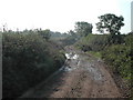


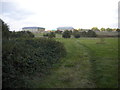

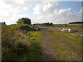

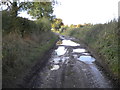
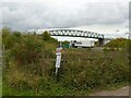
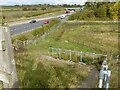

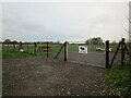
34 photos from this area
Area Information
Key information about the NG13 8AY including its size, population, and administrative classification.
- Area Type
- Postcode
- Area Size
- 1.7 km²
- Population
- 2851
- Population Density
- 494 people/km²
House Prices in NG13 8AY
81
Properties
£309,833
Average Sold Price
£92,500
Lowest Price
£650,000
Highest Price
Showing 81 properties
| Address | Type | Beds | Baths | Last Sale Price | Last Sale Date | |
|---|---|---|---|---|---|---|
| The Holdings, Main Street, Saxondale, NG13 8AY | Semi-detached | 3 | 1 | £329,000 | Aug 2022 | |
| Orchard Cottage, Main Street, Saxondale, NG13 8AY | house | 5 | 3 | £487,500 | May 2019 | |
| Newholme, Main Street, Saxondale, NG13 8AY | Semi-detached | 3 | 1 | £235,000 | Jan 2017 | |
| Hill View, Main Street, Saxondale, NG13 8AY | house | 3 | 2 | £200,000 | Jul 2016 | |
| Mount Pleasant, Main Street, Saxondale, NG13 8AY | house | 3 | 1 | £235,000 | Oct 2014 | |
| Inglenook Cottage, Grantham Road, Saxondale, NG13 8AY | Detached | 3 | 1 | £292,000 | Jun 2014 | |
| Orchard Barn, Main Street, Saxondale, NG13 8AY | Semi-detached | 5 | 4 | £650,000 | Dec 2004 | |
| The Laurels, Grantham Road, Saxondale, NG13 8AY | Semi-detached | - | - | £92,500 | Apr 2001 | |
| Sycamore Farm House, Main Street, Saxondale, NG13 8AY | Semi-detached | - | - | £267,500 | Apr 2001 | |
| Stoneacre, Grantham Road, Saxondale, NG13 8AY | Semi-detached | 4 | 1 | - | - |
Page 1 of 9
Energy Efficiency in NG13 8AY
Amenities
Schools
| Rank | School | Type | Entry gender | Ages |
|---|
Explore more schools in this area
Go to Schools tabDemographics
Household Size
Family (3-5 people)
most common
Accommodation Type
Houses
most common
Tenure
71
majority
Ethnic Group
White
most common
Religion
N/A
most common
Household Composition
N/A
most common
Age
47
median
Adults (30-64 years)
most common
Household Deprivation
N/A
with no deprivation
NS-SEC
46
in Lower managerial occupations
Explore more demographic insights in this area
Go to Demographics tabPlanning
Planning Constraints
- Flood RiskPremium
- Ramsar Wetland SitesPremium
- Area of Outstanding Natural BeautyPremium
- Protected Nature ReservePremium
- Protected WoodlandPremium