Area Overview for NG13 0HB
Photos of NG13 0HB
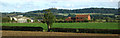
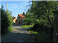
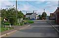
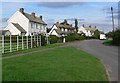
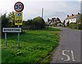
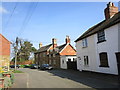
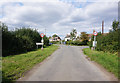
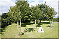
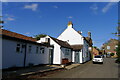
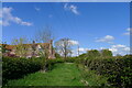
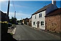
21 photos from this area
Area Information
Key information about the NG13 0HB including its size, population, and administrative classification.
- Area Type
- Postcode
- Area Size
- 1.8 hectares
- Population
- 1636
- Population Density
- 58 people/km²
House Prices in NG13 0HB
22
Properties
£328,431
Average Sold Price
£119,950
Lowest Price
£535,000
Highest Price
Showing 22 properties
| Address | Type | Beds | Baths | Last Sale Price | Last Sale Date | |
|---|---|---|---|---|---|---|
| 1B Middle Street, Barkestone Le Vale, NG13 0HB | Detached | 4 | 3 | £535,000 | Oct 2020 | |
| 11 Middle Street, Barkestone Le Vale, NG13 0HB | house | - | - | £480,000 | Oct 2018 | |
| 13 Middle Street, Barkestone Le Vale, NG13 0HB | Detached | 4 | 2 | £357,500 | Apr 2015 | |
| The Old Post Office, 5 Middle Street, Barkestone Le Vale, NG13 0HB | house | 4 | 1 | £217,500 | Sep 2014 | |
| 3 Middle Street, Barkestone Le Vale, NG13 0HB | Semi-detached | 2 | 1 | £172,500 | Feb 2014 | |
| The Gables, 5A Middle Street, Barkestone Le Vale, NG13 0HB | house | - | - | £380,000 | Dec 2007 | |
| 9 Middle Street, Barkestone Le Vale, NG13 0HB | Detached | - | - | £365,000 | Oct 2003 | |
| Rutland Cottage, 22 Middle Street, Barkestone Le Vale, NG13 0HB | house | - | - | £119,950 | Oct 1999 | |
| Castle View, 18 Middle Street, Barkestone Le Vale, NG13 0HB | Detached | 4 | 1 | - | - | |
| Braemar, 20 Middle Street, Barkestone Le Vale, NG13 0HB | Detached | - | - | - | - |
Page 1 of 3
Energy Efficiency in NG13 0HB
Amenities
Schools
| Rank | School | Type | Entry gender | Ages |
|---|
Explore more schools in this area
Go to Schools tabDemographics
Household Size
Two person
most common
Accommodation Type
Houses
most common
Tenure
80
majority
Ethnic Group
White
most common
Religion
N/A
most common
Household Composition
N/A
most common
Age
47
median
Adults (30-64 years)
most common
Household Deprivation
N/A
with no deprivation
NS-SEC
46
in Lower managerial occupations
Explore more demographic insights in this area
Go to Demographics tabPlanning
Planning Constraints
- Flood RiskPremium
- Ramsar Wetland SitesPremium
- Area of Outstanding Natural BeautyPremium
- Protected Nature ReservePremium
- Protected WoodlandPremium