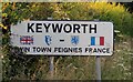
Area Overview for NG12 5JN
Photos of NG12 5JN
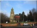
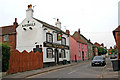
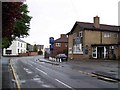
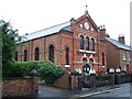
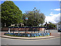
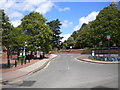
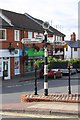
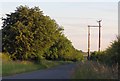
89 photos from this area
Area Information
Key information about the NG12 5JN including its size, population, and administrative classification.
- Area Type
- Postcode
- Area Size
- 10.6 hectares
- Population
- 1305
- Population Density
- 331 people/km²
House Prices in NG12 5JN
42
Properties
£261,955
Average Sold Price
£85,000
Lowest Price
£440,100
Highest Price
Showing 42 properties
| Address | Type | Beds | Baths | Last Sale Price | Last Sale Date | |
|---|---|---|---|---|---|---|
| 14 Brook View Drive, Keyworth, NG12 5JN | Detached | 4 | 2 | £400,000 | Jan 2024 | |
| 16 Brook View Drive, Keyworth, NG12 5JN | Detached | 4 | 2 | £400,000 | Dec 2022 | |
| 35 Brook View Drive, Keyworth, NG12 5JN | house | - | - | £385,000 | Sep 2021 | |
| 44 Brook View Drive, Keyworth, NG12 5JN | house | - | - | £440,100 | Jun 2021 | |
| 31 Brook View Drive, Keyworth, NG12 5JN | house | - | - | £378,000 | May 2021 | |
| 21 Brook View Drive, Keyworth, NG12 5JN | Detached | 5 | 2 | £365,000 | Aug 2019 | |
| 40 Brook View Drive, Keyworth, NG12 5JN | Detached | 4 | 2 | £410,000 | Feb 2019 | |
| 4 Brook View Drive, Keyworth, NG12 5JN | Detached | 4 | 1 | £225,000 | Jul 2014 | |
| 36 Brook View Drive, Keyworth, NG12 5JN | Detached | 4 | 1 | £265,000 | Feb 2014 | |
| 38 Brook View Drive, Keyworth, NG12 5JN | Detached | 4 | 1 | £275,000 | Aug 2013 |
Page 1 of 5
Energy Efficiency in NG12 5JN
Amenities
Schools
| Rank | School | Type | Entry gender | Ages |
|---|
Explore more schools in this area
Go to Schools tabDemographics
Household Size
Two person
most common
Accommodation Type
Houses
most common
Tenure
91
majority
Ethnic Group
White
most common
Religion
N/A
most common
Household Composition
N/A
most common
Age
47
median
Adults (30-64 years)
most common
Household Deprivation
N/A
with no deprivation
NS-SEC
41
in Lower managerial occupations
Explore more demographic insights in this area
Go to Demographics tabPlanning
Planning Constraints
- Flood RiskPremium
- Ramsar Wetland SitesPremium
- Area of Outstanding Natural BeautyPremium
- Protected Nature ReservePremium
- Protected WoodlandPremium