Area Overview for NG12 2HN
Photos of NG12 2HN

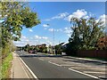
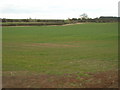
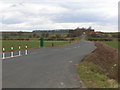

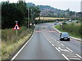

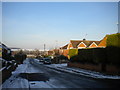
18 photos from this area
Area Information
Key information about the NG12 2HN including its size, population, and administrative classification.
- Area Type
- Postcode
- Area Size
- 9.3 hectares
- Population
- 1097
- Population Density
- 789 people/km²
House Prices in NG12 2HN
35
Properties
£216,156
Average Sold Price
£93,250
Lowest Price
£390,000
Highest Price
Showing 35 properties
| Address | Type | Beds | Baths | Last Sale Price | Last Sale Date | |
|---|---|---|---|---|---|---|
| 45 Covert Crescent, Radcliffe On Trent, NG12 2HN | Detached | 3 | 1 | £390,000 | May 2024 | |
| 73 Covert Crescent, Radcliffe On Trent, NG12 2HN | Bungalow | - | - | £256,600 | Jun 2022 | |
| 17 Covert Crescent, Radcliffe On Trent, NG12 2HN | Bungalow | 2 | 1 | £215,000 | Jul 2019 | |
| 57 Covert Crescent, Radcliffe On Trent, NG12 2HN | Detached | 4 | 1 | £327,000 | Jul 2019 | |
| 23 Covert Crescent, Radcliffe On Trent, NG12 2HN | house | - | - | £300,000 | Oct 2018 | |
| 5 Covert Crescent, Radcliffe On Trent, NG12 2HN | Bungalow | 2 | 1 | £225,000 | Dec 2017 | |
| 43 Covert Crescent, Radcliffe On Trent, NG12 2HN | Detached | 5 | 1 | £340,000 | Oct 2017 | |
| 33 Covert Crescent, Radcliffe On Trent, NG12 2HN | Detached | 4 | 1 | £285,000 | Jun 2017 | |
| 19 Covert Crescent, Radcliffe On Trent, NG12 2HN | Bungalow | 2 | 1 | £214,995 | Apr 2017 | |
| 49 Covert Crescent, Radcliffe On Trent, NG12 2HN | Detached | 3 | - | £235,000 | Dec 2014 |
Page 1 of 4
Energy Efficiency in NG12 2HN
Amenities
Schools
| Rank | School | Type | Entry gender | Ages |
|---|
Explore more schools in this area
Go to Schools tabDemographics
Household Size
Two person
most common
Accommodation Type
Houses
most common
Tenure
92
majority
Ethnic Group
White
most common
Religion
N/A
most common
Household Composition
N/A
most common
Age
47
median
Adults (30-64 years)
most common
Household Deprivation
N/A
with no deprivation
NS-SEC
49
in Lower managerial occupations
Explore more demographic insights in this area
Go to Demographics tabPlanning
Planning Constraints
- Flood RiskPremium
- Ramsar Wetland SitesPremium
- Area of Outstanding Natural BeautyPremium
- Protected Nature ReservePremium
- Protected WoodlandPremium