Area Overview for NG12 1EN
Photos of NG12 1EN

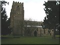
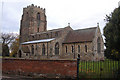
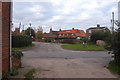
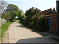
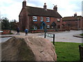
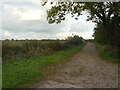
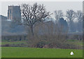
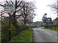
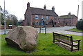
56 photos from this area
Area Information
Key information about the NG12 1EN including its size, population, and administrative classification.
- Area Type
- Postcode
- Area Size
- 23.0 hectares
- Population
- 2064
- Population Density
- 140 people/km²
House Prices in NG12 1EN
16
Properties
£450,400
Average Sold Price
£337,500
Lowest Price
£600,000
Highest Price
Showing 16 properties
| Address | Type | Beds | Baths | Last Sale Price | Last Sale Date | |
|---|---|---|---|---|---|---|
| Holly Farm, Church Street, Shelford, NG12 1EN | Detached | 4 | 1 | £600,000 | Nov 2020 | |
| Granby House, Church Street, Shelford, NG12 1EN | Detached | 4 | 3 | £535,000 | Sep 2019 | |
| Starbucks Cottage, Church Street, Shelford, NG12 1EN | Detached | 4 | 2 | £390,000 | Feb 2017 | |
| The Willows, Church Street, Shelford, NG12 1EN | Detached | 3 | - | £389,500 | Jul 2014 | |
| Kibbles Cottage, Church Street, Shelford, NG12 1EN | Semi-detached | - | - | £337,500 | Mar 2010 | |
| Churchside, Church Street, Shelford, NG12 1EN | house | 4 | 3 | - | - | |
| Hardwick, Church Street, Shelford, NG12 1EN | Detached | 4 | 2 | - | - | |
| Shelcliffe Cottage, Church Street, Shelford, NG12 1EN | Detached | 4 | 2 | - | - | |
| 2, Church Cottages, Church Street, Shelford, NG12 1EN | house | 3 | 1 | - | - | |
| New Crown Cottage, Church Street, Shelford, NG12 1EN | house | - | - | - | - |
Page 1 of 2
Energy Efficiency in NG12 1EN
Amenities
Schools
| Rank | School | Type | Entry gender | Ages |
|---|
Explore more schools in this area
Go to Schools tabDemographics
Household Size
Family (3-5 people)
most common
Accommodation Type
Houses
most common
Tenure
86
majority
Ethnic Group
White
most common
Religion
N/A
most common
Household Composition
N/A
most common
Age
47
median
Adults (30-64 years)
most common
Household Deprivation
N/A
with no deprivation
NS-SEC
52
in Lower managerial occupations
Explore more demographic insights in this area
Go to Demographics tabPlanning
Planning Constraints
- Flood RiskPremium
- Ramsar Wetland SitesPremium
- Area of Outstanding Natural BeautyPremium
- Protected Nature ReservePremium
- Protected WoodlandPremium