Area Overview for NG12 1DX
Photos of NG12 1DX
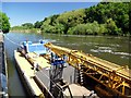


50 photos from this area
Area Information
Key information about the NG12 1DX including its size, population, and administrative classification.
- Area Type
- Postcode
- Area Size
- 13.4 hectares
- Population
- 2064
- Population Density
- 140 people/km²
House Prices in NG12 1DX
46
Properties
£351,567
Average Sold Price
£220,000
Lowest Price
£490,000
Highest Price
Showing 46 properties
| Address | Type | Beds | Baths | Last Sale Price | Last Sale Date | |
|---|---|---|---|---|---|---|
| 5 Hallam Drive, Radcliffe On Trent, NG12 1DX | Detached | 4 | 2 | £457,000 | Jun 2025 | |
| 65 Hallam Drive, Radcliffe On Trent, NG12 1DX | Detached | 3 | 2 | £315,000 | Feb 2025 | |
| 97 Hallam Drive, Radcliffe On Trent, NG12 1DX | house | - | - | £400,000 | Jan 2024 | |
| 103 Hallam Drive, Radcliffe On Trent, NG12 1DX | house | - | - | £349,000 | Dec 2023 | |
| 7 Hallam Drive, Radcliffe On Trent, NG12 1DX | Detached | 3 | 2 | £315,000 | Dec 2023 | |
| 101 Hallam Drive, Radcliffe On Trent, NG12 1DX | house | - | - | £475,000 | Nov 2023 | |
| 99 Hallam Drive, Radcliffe On Trent, NG12 1DX | house | - | - | £349,000 | Nov 2023 | |
| 91 Hallam Drive, Radcliffe On Trent, NG12 1DX | house | - | - | £400,000 | Oct 2023 | |
| 89 Hallam Drive, Radcliffe On Trent, NG12 1DX | house | - | - | £400,000 | Oct 2022 | |
| 81 Hallam Drive, Radcliffe On Trent, NG12 1DX | house | - | - | £309,000 | May 2022 |
Page 1 of 5
Energy Efficiency in NG12 1DX
Amenities
Schools
| Rank | School | Type | Entry gender | Ages |
|---|
Explore more schools in this area
Go to Schools tabDemographics
Household Size
Family (3-5 people)
most common
Accommodation Type
Houses
most common
Tenure
86
majority
Ethnic Group
White
most common
Religion
N/A
most common
Household Composition
N/A
most common
Age
47
median
Adults (30-64 years)
most common
Household Deprivation
N/A
with no deprivation
NS-SEC
52
in Lower managerial occupations
Explore more demographic insights in this area
Go to Demographics tabPlanning
Planning Constraints
- Flood RiskPremium
- Ramsar Wetland SitesPremium
- Area of Outstanding Natural BeautyPremium
- Protected Nature ReservePremium
- Protected WoodlandPremium