Area Overview for NG11 7HN
Photos of NG11 7HN


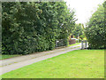
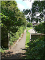
100 photos from this area
Area Information
Key information about the NG11 7HN including its size, population, and administrative classification.
- Area Type
- Postcode
- Area Size
- 1.2 hectares
- Population
- 1886
- Population Density
- 3895 people/km²
House Prices in NG11 7HN
21
Properties
£322,500
Average Sold Price
£250,000
Lowest Price
£370,000
Highest Price
Showing 21 properties
| Address | Type | Beds | Baths | Last Sale Price | Last Sale Date | |
|---|---|---|---|---|---|---|
| 4 Firmin Way, Nottingham, NG11 7HN | Semi-detached | 3 | 2 | £370,000 | Jul 2023 | |
| 11 Firmin Way, Nottingham, NG11 7HN | house | - | - | £330,000 | Oct 2021 | |
| 15 Firmin Way, Nottingham, NG11 7HN | house | - | - | £340,000 | Sep 2021 | |
| 19 Firmin Way, Nottingham, NG11 7HN | house | - | - | £250,000 | Jul 2021 | |
| 7 Firmin Way, Nottingham, NG11 7HN | Detached | 3 | 2 | - | - | |
| 3 Firmin Way, Nottingham, NG11 7HN | Land | - | - | - | - | |
| 27 Firmin Way, Nottingham, NG11 7HN | Detached | 4 | 3 | - | - | |
| 17A Firmin Way, Nottingham, NG11 7HN | Detached | 4 | 3 | - | - | |
| 14 Firmin Way, Nottingham, NG11 7HN | Detached | 4 | 3 | - | - | |
| Plot 2.1, Southern Portion Of Site Of Former Allotments East Of 101 To 127, Ruddington Lane, Nottingham, NG11 7HN | Detached | 4 | 2 | - | - |
Page 1 of 3
Energy Efficiency in NG11 7HN
Amenities
Schools
| Rank | School | Type | Entry gender | Ages |
|---|
Explore more schools in this area
Go to Schools tabDemographics
Household Size
Two person
most common
Accommodation Type
Houses
most common
Tenure
78
majority
Ethnic Group
White
most common
Religion
N/A
most common
Household Composition
N/A
most common
Age
47
median
Adults (30-64 years)
most common
Household Deprivation
N/A
with no deprivation
NS-SEC
46
in Lower managerial occupations
Explore more demographic insights in this area
Go to Demographics tabPlanning
Planning Constraints
- Flood RiskPremium
- Ramsar Wetland SitesPremium
- Area of Outstanding Natural BeautyPremium
- Protected Nature ReservePremium
- Protected WoodlandPremium