Area Overview for NG11 7FE
Photos of NG11 7FE
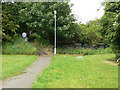
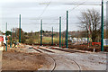

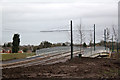
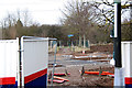
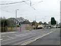
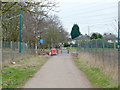
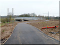
100 photos from this area
Area Information
Key information about the NG11 7FE including its size, population, and administrative classification.
- Area Type
- Postcode
- Area Size
- 1.3 hectares
- Population
- 1447
- Population Density
- 3177 people/km²
House Prices in NG11 7FE
24
Properties
£201,029
Average Sold Price
£62,000
Lowest Price
£300,000
Highest Price
Showing 24 properties
| Address | Type | Beds | Baths | Last Sale Price | Last Sale Date | |
|---|---|---|---|---|---|---|
| 59 Brookthorpe Way, Nottingham, NG11 7FE | Bungalow | 4 | 1 | £260,000 | Jan 2025 | |
| 43 Brookthorpe Way, Nottingham, NG11 7FE | Semi-detached | 2 | 1 | £240,000 | Jan 2025 | |
| 89 Brookthorpe Way, Nottingham, NG11 7FE | Semi-detached | 5 | 2 | £290,000 | Mar 2023 | |
| 85 Brookthorpe Way, Nottingham, NG11 7FE | Semi-detached | 3 | 1 | £230,000 | Jan 2023 | |
| 77 Brookthorpe Way, Nottingham, NG11 7FE | Bungalow | - | - | £300,000 | Aug 2022 | |
| 75 Brookthorpe Way, Nottingham, NG11 7FE | Semi-detached | 3 | 1 | £200,000 | Feb 2021 | |
| 67 Brookthorpe Way, Nottingham, NG11 7FE | Bungalow | 2 | - | £230,000 | Jan 2021 | |
| 79 Brookthorpe Way, Nottingham, NG11 7FE | Semi-detached | 4 | 2 | £242,500 | Jun 2020 | |
| 45 Brookthorpe Way, Nottingham, NG11 7FE | Semi-detached | 3 | 1 | £193,000 | Oct 2019 | |
| 71 Brookthorpe Way, Nottingham, NG11 7FE | Bungalow | - | - | £175,000 | Aug 2019 |
Page 1 of 3
Energy Efficiency in NG11 7FE
Amenities
Schools
| Rank | School | Type | Entry gender | Ages |
|---|
Explore more schools in this area
Go to Schools tabDemographics
Household Size
Two person
most common
Accommodation Type
Houses
most common
Tenure
89
majority
Ethnic Group
White
most common
Religion
N/A
most common
Household Composition
N/A
most common
Age
47
median
Adults (30-64 years)
most common
Household Deprivation
N/A
with no deprivation
NS-SEC
31
in Lower managerial occupations
Explore more demographic insights in this area
Go to Demographics tabPlanning
Planning Constraints
- Flood RiskPremium
- Ramsar Wetland SitesPremium
- Area of Outstanding Natural BeautyPremium
- Protected Nature ReservePremium
- Protected WoodlandPremium