Area Overview for NG11 0AB
Photos of NG11 0AB
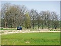
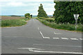
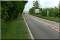
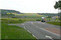
50 photos from this area
Area Information
Key information about the NG11 0AB including its size, population, and administrative classification.
- Area Type
- Postcode
- Area Size
- 1.2 km²
- Population
- 2003
- Population Density
- 90 people/km²
House Prices in NG11 0AB
6
Properties
£517,500
Average Sold Price
£295,000
Lowest Price
£740,000
Highest Price
Showing 6 properties
| Address | Type | Beds | Baths | Last Sale Price | Last Sale Date | |
|---|---|---|---|---|---|---|
| Barton Lodge, Barton Lane, Barton In Fabis, NG11 0AB | Detached | 5 | 2 | £740,000 | Dec 2016 | |
| Keepers Cottage, Barton Lane, Barton In Fabis, NG11 0AB | Detached | - | - | £295,000 | Jul 2007 | |
| Top Farm Cottage, Barton Lane, Barton In Fabis, NG11 0AB | Detached | - | - | - | - | |
| Barton Lodge Coach House, New Road, Barton In Fabis, NG11 0AB | Detached | - | - | - | - | |
| The Forge, Barton Lane, Barton In Fabis, NG11 0AB | Terraced | - | - | - | - | |
| Caravan Located At Bottom Of Field, Top Farm, Barton Lane, Barton In Fabis, NG11 0AB | Mobile Home | - | - | - | - |
Energy Efficiency in NG11 0AB
Amenities
Schools
| Rank | School | Type | Entry gender | Ages |
|---|
Explore more schools in this area
Go to Schools tabDemographics
Household Size
Two person
most common
Accommodation Type
Houses
most common
Tenure
80
majority
Ethnic Group
White
most common
Religion
N/A
most common
Household Composition
N/A
most common
Age
47
median
Adults (30-64 years)
most common
Household Deprivation
N/A
with no deprivation
NS-SEC
42
in Lower managerial occupations
Explore more demographic insights in this area
Go to Demographics tabPlanning
Planning Constraints
- Flood RiskPremium
- Ramsar Wetland SitesPremium
- Area of Outstanding Natural BeautyPremium
- Protected Nature ReservePremium
- Protected WoodlandPremium