Area Overview for NG10 4HN
Photos of NG10 4HN
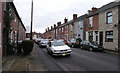
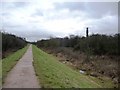
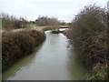
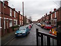


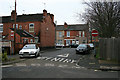


100 photos from this area
Area Information
Key information about the NG10 4HN including its size, population, and administrative classification.
- Area Type
- Postcode
- Area Size
- 8994 m²
- Population
- 1741
- Population Density
- 7440 people/km²
House Prices in NG10 4HN
10
Properties
£83,150
Average Sold Price
£34,950
Lowest Price
£136,000
Highest Price
Showing 10 properties
| Address | Type | Beds | Baths | Last Sale Price | Last Sale Date | |
|---|---|---|---|---|---|---|
| 9 Canal Street, Long Eaton, NG10 4HN | Terraced | 2 | 1 | £136,000 | May 2022 | |
| 13 Canal Street, Long Eaton, NG10 4HN | Terraced | 2 | - | £78,500 | Sep 2005 | |
| 11 Canal Street, Long Eaton, NG10 4HN | Terraced | - | - | £34,950 | May 2001 | |
| 7 Canal Street, Long Eaton, NG10 4HN | Terraced | 2 | 1 | - | - | |
| 5 Canal Street, Long Eaton, NG10 4HN | Terraced | 2 | 1 | - | - | |
| Mrs B Luncheon Service, Units 8 And 9, Trent Business Centre, Canal Street, Long Eaton, NG10 4HN | Office | - | - | - | - | |
| Central One Systems Ltd, Unit 51, Trent Business Centre, Canal Street, Long Eaton, NG10 4HN | Office | - | - | - | - | |
| Skcin, Unit 5, Trent Business Centre, Canal Street, Long Eaton, NG10 4HN | Office | - | - | - | - | |
| Fastlok Manufacturing Ltd, Mill House, 3 Canal Street, Long Eaton, NG10 4HN | Industrial | - | - | - | - | |
| Unit 3, Trent Business Centre, Canal Street, Long Eaton, NG10 4HN | Office | - | - | - | - |
Energy Efficiency in NG10 4HN
Amenities
Schools
| Rank | School | Type | Entry gender | Ages |
|---|
Explore more schools in this area
Go to Schools tabDemographics
Household Size
Two person
most common
Accommodation Type
Houses
most common
Tenure
63
majority
Ethnic Group
White
most common
Religion
N/A
most common
Household Composition
N/A
most common
Age
47
median
Adults (30-64 years)
most common
Household Deprivation
N/A
with no deprivation
NS-SEC
31
in Lower managerial occupations
Explore more demographic insights in this area
Go to Demographics tabPlanning
Planning Constraints
- Flood RiskPremium
- Ramsar Wetland SitesPremium
- Area of Outstanding Natural BeautyPremium
- Protected Nature ReservePremium
- Protected WoodlandPremium