Area Overview for NG10 4FJ
Photos of NG10 4FJ
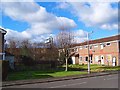
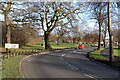
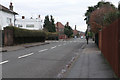
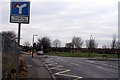
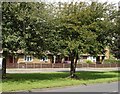

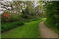
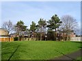


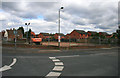
37 photos from this area
Area Information
Key information about the NG10 4FJ including its size, population, and administrative classification.
- Area Type
- Postcode
- Area Size
- 1.1 hectares
- Population
- 1439
- Population Density
- 5550 people/km²
House Prices in NG10 4FJ
31
Properties
£205,458
Average Sold Price
£55,000
Lowest Price
£387,250
Highest Price
Showing 31 properties
| Address | Type | Beds | Baths | Last Sale Price | Last Sale Date | |
|---|---|---|---|---|---|---|
| 223 Curzon Street, Long Eaton, NG10 4FJ | Detached | 3 | 1 | £387,250 | Aug 2025 | |
| 287 Curzon Street, Long Eaton, NG10 4FJ | Detached | 3 | 2 | £290,000 | Aug 2022 | |
| 285 Curzon Street, Long Eaton, NG10 4FJ | Semi-detached | 3 | 1 | £212,000 | Jul 2022 | |
| 283 Curzon Street, Long Eaton, NG10 4FJ | Semi-detached | 4 | 2 | £247,000 | Oct 2021 | |
| 279 Curzon Street, Long Eaton, NG10 4FJ | house | - | - | £255,000 | Jul 2021 | |
| 281 Curzon Street, Long Eaton, NG10 4FJ | Semi-detached | 4 | 1 | £140,000 | Jan 2020 | |
| 235 Curzon Street, Long Eaton, NG10 4FJ | Detached | 4 | 1 | £340,000 | Jan 2020 | |
| 269 Curzon Street, Long Eaton, NG10 4FJ | Detached | 4 | 1 | £295,000 | Feb 2019 | |
| 227 Curzon Street, Long Eaton, NG10 4FJ | house | - | - | £210,000 | Mar 2016 | |
| 265 Curzon Street, Long Eaton, NG10 4FJ | Detached | 3 | - | £255,000 | Sep 2015 |
Page 1 of 4
Energy Efficiency in NG10 4FJ
Amenities
Schools
| Rank | School | Type | Entry gender | Ages |
|---|
Explore more schools in this area
Go to Schools tabDemographics
Household Size
Two person
most common
Accommodation Type
Houses
most common
Tenure
80
majority
Ethnic Group
White
most common
Religion
N/A
most common
Household Composition
N/A
most common
Age
47
median
Adults (30-64 years)
most common
Household Deprivation
N/A
with no deprivation
NS-SEC
37
in Lower managerial occupations
Explore more demographic insights in this area
Go to Demographics tabPlanning
Planning Constraints
- Flood RiskPremium
- Ramsar Wetland SitesPremium
- Area of Outstanding Natural BeautyPremium
- Protected Nature ReservePremium
- Protected WoodlandPremium