Area Overview for NG10 3HP
Photos of NG10 3HP
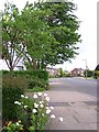

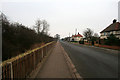
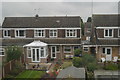
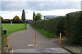
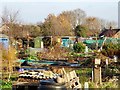


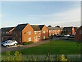
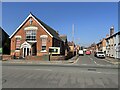
32 photos from this area
Area Information
Key information about the NG10 3HP including its size, population, and administrative classification.
- Area Type
- Postcode
- Area Size
- 8193 m²
- Population
- 1808
- Population Density
- 2890 people/km²
House Prices in NG10 3HP
22
Properties
£226,622
Average Sold Price
£64,950
Lowest Price
£392,000
Highest Price
Showing 22 properties
| Address | Type | Beds | Baths | Last Sale Price | Last Sale Date | |
|---|---|---|---|---|---|---|
| 23 Dovedale Avenue, Long Eaton, NG10 3HP | Detached | 3 | 1 | £287,500 | Mar 2025 | |
| 33 Dovedale Avenue, Long Eaton, NG10 3HP | Semi-detached | 3 | 1 | £245,000 | Jun 2024 | |
| 41 Dovedale Avenue, Long Eaton, NG10 3HP | Detached | 3 | 2 | £355,000 | May 2023 | |
| 7 Dovedale Avenue, Long Eaton, NG10 3HP | Semi-detached | 3 | 1 | £260,000 | Oct 2022 | |
| 15 Dovedale Avenue, Long Eaton, NG10 3HP | house | - | - | £392,000 | Jun 2022 | |
| 3 Dovedale Avenue, Long Eaton, NG10 3HP | house | 3 | 1 | £240,000 | Apr 2022 | |
| 25 Dovedale Avenue, Long Eaton, NG10 3HP | Detached | 3 | 1 | £275,000 | Nov 2021 | |
| 37 Dovedale Avenue, Long Eaton, NG10 3HP | house | - | - | £252,000 | Apr 2021 | |
| 49 Dovedale Avenue, Long Eaton, NG10 3HP | Detached | 3 | 1 | £280,000 | Feb 2020 | |
| 29 Dovedale Avenue, Long Eaton, NG10 3HP | Semi-detached | 3 | 1 | £200,000 | May 2019 |
Page 1 of 3
Energy Efficiency in NG10 3HP
Amenities
Schools
| Rank | School | Type | Entry gender | Ages |
|---|
Explore more schools in this area
Go to Schools tabDemographics
Household Size
Two person
most common
Accommodation Type
Houses
most common
Tenure
89
majority
Ethnic Group
White
most common
Religion
N/A
most common
Household Composition
N/A
most common
Age
47
median
Adults (30-64 years)
most common
Household Deprivation
N/A
with no deprivation
NS-SEC
44
in Lower managerial occupations
Explore more demographic insights in this area
Go to Demographics tabPlanning
Planning Constraints
- Flood RiskPremium
- Ramsar Wetland SitesPremium
- Area of Outstanding Natural BeautyPremium
- Protected Nature ReservePremium
- Protected WoodlandPremium