Area Overview for NG10 3FZ
Photos of NG10 3FZ
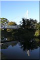
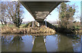
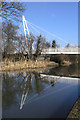
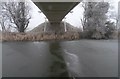
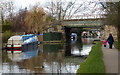
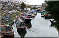
100 photos from this area
Area Information
Key information about the NG10 3FZ including its size, population, and administrative classification.
- Area Type
- Postcode
- Area Size
- 1.9 hectares
- Population
- 1695
- Population Density
- 2870 people/km²
House Prices in NG10 3FZ
5
Properties
£15,250,000
Average Sold Price
£15,250,000
Lowest Price
£15,250,000
Highest Price
Showing 5 properties
| Address | Type | Beds | Baths | Last Sale Price | Last Sale Date | |
|---|---|---|---|---|---|---|
| Non Grata East Of 61 Oakland Avenue, Fields Farm Road, Long Eaton, NG10 3FZ | Houseboat | - | - | £15,250,000 | Sep 2013 | |
| Peppa Mooring 2 Erewash Canal Rear Of Unit 1 Pidcock Motorcycles, Fields Farm Road, Long Eaton, NG10 3FZ | Houseboat | - | - | - | - | |
| Shires Motorcycle Training, Office At, Unit 2, Fields Farm Road, Long Eaton, NG10 3FZ | Office | - | - | - | - | |
| Mizpah Adjacent To Unit 1, Fields Farm Road, Long Eaton, NG10 3FZ | Houseboat | - | - | - | - | |
| R And C Wilson Ltd, Fields Farm Road, Long Eaton, NG10 3FZ | Industrial | - | - | - | - |
Energy Efficiency in NG10 3FZ
Amenities
Schools
| Rank | School | Type | Entry gender | Ages |
|---|
Explore more schools in this area
Go to Schools tabDemographics
Household Size
Two person
most common
Accommodation Type
Houses
most common
Tenure
73
majority
Ethnic Group
White
most common
Religion
N/A
most common
Household Composition
N/A
most common
Age
47
median
Adults (30-64 years)
most common
Household Deprivation
N/A
with no deprivation
NS-SEC
34
in Lower managerial occupations
Explore more demographic insights in this area
Go to Demographics tabPlanning
Planning Constraints
- Flood RiskPremium
- Ramsar Wetland SitesPremium
- Area of Outstanding Natural BeautyPremium
- Protected Nature ReservePremium
- Protected WoodlandPremium