Area Overview for NG10 3DZ
Photos of NG10 3DZ
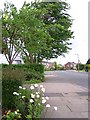

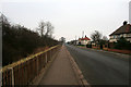
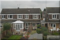
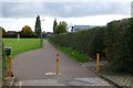
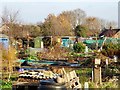
32 photos from this area
Area Information
Key information about the NG10 3DZ including its size, population, and administrative classification.
- Area Type
- Postcode
- Area Size
- 5580 m²
- Population
- 1503
- Population Density
- 4404 people/km²
House Prices in NG10 3DZ
10
Properties
£141,357
Average Sold Price
£80,000
Lowest Price
£245,000
Highest Price
Showing 10 properties
| Address | Type | Beds | Baths | Last Sale Price | Last Sale Date | |
|---|---|---|---|---|---|---|
| 15 Beresford Road, Sawley, NG10 3DZ | Semi-detached | 3 | 1 | £245,000 | May 2023 | |
| 41 Beresford Road, Sawley, NG10 3DZ | Retail | 3 | 1 | £180,000 | Jul 2022 | |
| 25 Beresford Road, Sawley, NG10 3DZ | Semi-detached | 3 | 1 | £170,000 | Jan 2019 | |
| 19 Beresford Road, Sawley, NG10 3DZ | Terraced | 3 | 1 | £115,000 | Jan 2017 | |
| 23 Beresford Road, Sawley, NG10 3DZ | Semi-detached | 2 | - | £107,000 | Oct 2015 | |
| 17 Beresford Road, Sawley, NG10 3DZ | Semi-detached | 3 | 1 | £92,500 | Sep 2013 | |
| 21 Beresford Road, Sawley, NG10 3DZ | house | - | - | £80,000 | Jan 2011 | |
| 27 Beresford Road, Sawley, NG10 3DZ | Semi-detached | - | - | - | - | |
| 43 Beresford Road, Sawley, NG10 3DZ | house | - | - | - | - | |
| 13 Beresford Road, Sawley, NG10 3DZ | house | 3 | - | - | - |
Energy Efficiency in NG10 3DZ
Amenities
Schools
| Rank | School | Type | Entry gender | Ages |
|---|
Explore more schools in this area
Go to Schools tabDemographics
Household Size
One person
most common
Accommodation Type
Houses
most common
Tenure
40
majority
Ethnic Group
White
most common
Religion
N/A
most common
Household Composition
N/A
most common
Age
47
median
Adults (30-64 years)
most common
Household Deprivation
N/A
with no deprivation
NS-SEC
18
in Lower managerial occupations
Explore more demographic insights in this area
Go to Demographics tabPlanning
Planning Constraints
- Flood RiskPremium
- Ramsar Wetland SitesPremium
- Area of Outstanding Natural BeautyPremium
- Protected Nature ReservePremium
- Protected WoodlandPremium