Area Overview for NG10 2FR
Photos of NG10 2FR
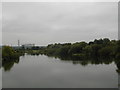
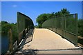
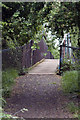
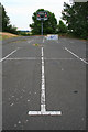
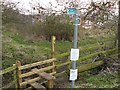
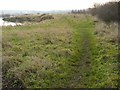
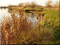
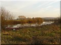
100 photos from this area
Area Information
Key information about the NG10 2FR including its size, population, and administrative classification.
- Area Type
- Postcode
- Area Size
- 8.9 hectares
- Population
- 1448
- Population Density
- 398 people/km²
House Prices in NG10 2FR
34
Properties
£197,276
Average Sold Price
£55,500
Lowest Price
£320,000
Highest Price
Showing 34 properties
| Address | Type | Beds | Baths | Last Sale Price | Last Sale Date | |
|---|---|---|---|---|---|---|
| 35 Owen Avenue, Long Eaton, NG10 2FR | Detached | 3 | 1 | £235,000 | Apr 2025 | |
| 17 Owen Avenue, Long Eaton, NG10 2FR | Bungalow | 2 | 1 | £260,000 | Jul 2023 | |
| 63 Owen Avenue, Long Eaton, NG10 2FR | Bungalow | - | - | £270,000 | Jun 2021 | |
| 49 Owen Avenue, Long Eaton, NG10 2FR | Bungalow | 2 | - | £320,000 | Jun 2021 | |
| 45 Owen Avenue, Long Eaton, NG10 2FR | Bungalow | 3 | 1 | £250,000 | Jun 2021 | |
| 47 Owen Avenue, Long Eaton, NG10 2FR | Bungalow | 3 | 1 | £245,000 | Apr 2021 | |
| 25 Owen Avenue, Long Eaton, NG10 2FR | Semi-detached | 3 | 1 | £200,000 | Mar 2021 | |
| 39 Owen Avenue, Long Eaton, NG10 2FR | Bungalow | 3 | 2 | £319,995 | Jul 2018 | |
| 69 Owen Avenue, Long Eaton, NG10 2FR | Bungalow | - | - | £245,000 | Jan 2017 | |
| 13 Owen Avenue, Long Eaton, NG10 2FR | Semi-detached | 2 | - | £140,000 | Oct 2016 |
Page 1 of 4
Energy Efficiency in NG10 2FR
Amenities
Schools
| Rank | School | Type | Entry gender | Ages |
|---|
Explore more schools in this area
Go to Schools tabDemographics
Household Size
Two person
most common
Accommodation Type
Houses
most common
Tenure
84
majority
Ethnic Group
White
most common
Religion
N/A
most common
Household Composition
N/A
most common
Age
47
median
Adults (30-64 years)
most common
Household Deprivation
N/A
with no deprivation
NS-SEC
32
in Lower managerial occupations
Explore more demographic insights in this area
Go to Demographics tabPlanning
Planning Constraints
- Flood RiskPremium
- Ramsar Wetland SitesPremium
- Area of Outstanding Natural BeautyPremium
- Protected Nature ReservePremium
- Protected WoodlandPremium