Area Overview for NG10 2EA
Photos of NG10 2EA

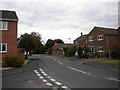
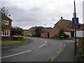
100 photos from this area
Area Information
Key information about the NG10 2EA including its size, population, and administrative classification.
- Area Type
- Postcode
- Area Size
- 1.2 hectares
- Population
- 1448
- Population Density
- 398 people/km²
House Prices in NG10 2EA
43
Properties
£144,248
Average Sold Price
£43,500
Lowest Price
£264,000
Highest Price
Showing 43 properties
| Address | Type | Beds | Baths | Last Sale Price | Last Sale Date | |
|---|---|---|---|---|---|---|
| 53 Stafford Street, Long Eaton, NG10 2EA | Semi-detached | 3 | 1 | £222,000 | Jul 2025 | |
| 47 Stafford Street, Long Eaton, NG10 2EA | Terraced | 3 | 1 | £127,500 | Jun 2024 | |
| 72 Stafford Street, Long Eaton, NG10 2EA | Detached | 3 | 1 | £264,000 | Apr 2024 | |
| 67 Stafford Street, Long Eaton, NG10 2EA | Retail | 3 | 1 | £224,000 | May 2022 | |
| 82 Stafford Street, Long Eaton, NG10 2EA | Semi-detached | 3 | 1 | £201,000 | May 2021 | |
| 61 Stafford Street, Long Eaton, NG10 2EA | house | - | - | £158,000 | Apr 2021 | |
| 60 Stafford Street, Long Eaton, NG10 2EA | house | - | - | £159,000 | Apr 2021 | |
| 55 Stafford Street, Long Eaton, NG10 2EA | Semi-detached | 3 | 1 | £190,000 | Feb 2021 | |
| 78 Stafford Street, Long Eaton, NG10 2EA | house | - | - | £225,000 | Jan 2021 | |
| 84 Stafford Street, Long Eaton, NG10 2EA | Semi-detached | 3 | 1 | £162,000 | Dec 2019 |
Page 1 of 5
Energy Efficiency in NG10 2EA
Amenities
Schools
| Rank | School | Type | Entry gender | Ages |
|---|
Explore more schools in this area
Go to Schools tabDemographics
Household Size
Two person
most common
Accommodation Type
Houses
most common
Tenure
84
majority
Ethnic Group
White
most common
Religion
N/A
most common
Household Composition
N/A
most common
Age
47
median
Adults (30-64 years)
most common
Household Deprivation
N/A
with no deprivation
NS-SEC
32
in Lower managerial occupations
Explore more demographic insights in this area
Go to Demographics tabPlanning
Planning Constraints
- Flood RiskPremium
- Ramsar Wetland SitesPremium
- Area of Outstanding Natural BeautyPremium
- Protected Nature ReservePremium
- Protected WoodlandPremium