Area Overview for NG10 1HY
Photos of NG10 1HY
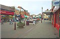
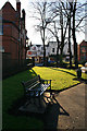
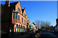

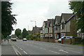
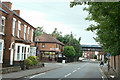
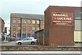
100 photos from this area
Area Information
Key information about the NG10 1HY including its size, population, and administrative classification.
- Area Type
- Postcode
- Area Size
- 4335 m²
- Population
- 1689
- Population Density
- 4241 people/km²
House Prices in NG10 1HY
39
Properties
£145,000
Average Sold Price
£145,000
Lowest Price
£145,000
Highest Price
Showing 39 properties
| Address | Type | Beds | Baths | Last Sale Price | Last Sale Date | |
|---|---|---|---|---|---|---|
| 25A High Street, Long Eaton, NG10 1HY | Retail | 1 | - | £145,000 | Feb 1995 | |
| Flat 3, 5 High Street, Long Eaton, NG10 1HY | Flat | 2 | 1 | - | - | |
| Flat 15, 5 High Street, Long Eaton, NG10 1HY | Flat | 1 | 1 | - | - | |
| Flat, 91A High Street, Long Eaton, NG10 1HY | Flat | - | - | - | - | |
| Flat, 17 High Street, Long Eaton, NG10 1HY | Flat | - | - | - | - | |
| Plot 2 Former Suite A, Above 7 To 13, High Street, Long Eaton, NG10 1HY | Office | - | - | - | - | |
| Plot 3 Former Suite A, Above 7 To 13, High Street, Long Eaton, NG10 1HY | Office | - | - | - | - | |
| Flat Over, 5 High Street, Long Eaton, NG10 1HY | Flat | - | - | - | - | |
| Plot 1 Former Suite A, Above 7 To 13, High Street, Long Eaton, NG10 1HY | Flat | - | - | - | - | |
| Flat At The Chameleon, 23 High Street, Long Eaton, NG10 1HY | Flat | 1 | 1 | - | - |
Page 1 of 4
Energy Efficiency in NG10 1HY
Amenities
Schools
| Rank | School | Type | Entry gender | Ages |
|---|
Explore more schools in this area
Go to Schools tabDemographics
Household Size
One person
most common
Accommodation Type
Houses
most common
Tenure
38
majority
Ethnic Group
White
most common
Religion
N/A
most common
Household Composition
N/A
most common
Age
47
median
Adults (30-64 years)
most common
Household Deprivation
N/A
with no deprivation
NS-SEC
23
in Lower managerial occupations
Explore more demographic insights in this area
Go to Demographics tabPlanning
Planning Constraints
- Flood RiskPremium
- Ramsar Wetland SitesPremium
- Area of Outstanding Natural BeautyPremium
- Protected Nature ReservePremium
- Protected WoodlandPremium