Area Overview for NG10 1BX
Photos of NG10 1BX
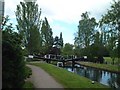


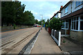
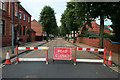
100 photos from this area
Area Information
Key information about the NG10 1BX including its size, population, and administrative classification.
- Area Type
- Postcode
- Area Size
- 1.0 hectares
- Population
- 1446
- Population Density
- 5412 people/km²
House Prices in NG10 1BX
60
Properties
£71,365
Average Sold Price
£28,000
Lowest Price
£140,000
Highest Price
Showing 60 properties
| Address | Type | Beds | Baths | Last Sale Price | Last Sale Date | |
|---|---|---|---|---|---|---|
| 56 Clumber Street, Long Eaton, NG10 1BX | Semi-detached | 2 | 1 | £140,000 | Sep 2020 | |
| 42 Clumber Street, Long Eaton, NG10 1BX | Semi-detached | 2 | 1 | £94,000 | Nov 2017 | |
| 54 Clumber Street, Long Eaton, NG10 1BX | Semi-detached | 2 | 1 | £89,000 | Apr 2015 | |
| 52 Clumber Street, Long Eaton, NG10 1BX | Semi-detached | 3 | - | £91,000 | Dec 2013 | |
| 38 Clumber Street, Long Eaton, NG10 1BX | house | - | - | £85,000 | Feb 2006 | |
| 36 Clumber Street, Long Eaton, NG10 1BX | house | - | - | £58,000 | Nov 2002 | |
| 46 Clumber Street, Long Eaton, NG10 1BX | Semi-detached | - | - | £59,950 | May 2002 | |
| 32 Clumber Street, Long Eaton, NG10 1BX | Terraced | 2 | 1 | £36,500 | Jun 2001 | |
| 34 Clumber Street, Long Eaton, NG10 1BX | Semi-detached | - | - | £28,000 | Feb 2001 | |
| 44 Clumber Street, Long Eaton, NG10 1BX | house | - | - | £32,200 | Oct 1996 |
Page 1 of 6
Energy Efficiency in NG10 1BX
Amenities
Schools
| Rank | School | Type | Entry gender | Ages |
|---|
Explore more schools in this area
Go to Schools tabDemographics
Household Size
Two person
most common
Accommodation Type
Houses
most common
Tenure
67
majority
Ethnic Group
White
most common
Religion
N/A
most common
Household Composition
N/A
most common
Age
47
median
Adults (30-64 years)
most common
Household Deprivation
N/A
with no deprivation
NS-SEC
26
in Lower managerial occupations
Explore more demographic insights in this area
Go to Demographics tabPlanning
Planning Constraints
- Flood RiskPremium
- Ramsar Wetland SitesPremium
- Area of Outstanding Natural BeautyPremium
- Protected Nature ReservePremium
- Protected WoodlandPremium