Area Overview for NG1 5FH
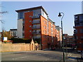
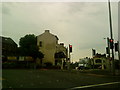
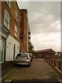
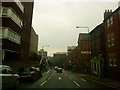
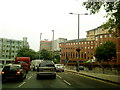
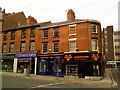
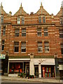
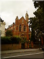
Photos of NG1 5FH


Area Information
Living in NG1 5FH offers a compact, residential experience within a small cluster of homes in Nottingham. With a population of 1,923, this area is characterised by a quiet, established community. The postcode covers a limited area, making it ideal for those seeking a manageable, low-traffic environment. Daily life here is shaped by the proximity to local amenities, including retail stores, transport hubs, and educational institutions. The area is well connected by tram and rail networks, with Nottingham Railway Station just a short distance away. Residents benefit from strong broadband connectivity and a moderate crime risk, offering a balance between convenience and safety. For those seeking a stable, community-focused lifestyle, NG1 5FH presents a straightforward option with a distinct character that reflects its local surroundings and infrastructure.
- Area Type
- Postcode
- Area Size
- Not available
- Population
- 1923
- Population Density
- 5266 people/km²
The property market in NG1 5FH is characterised by a 49% home ownership rate, indicating that nearly half of the properties are owner-occupied, while the remainder are likely rented. The predominant accommodation type is flats, which is typical for smaller, residential clusters. This suggests a housing stock that is well-suited to individuals or couples, rather than larger families. The compact size of the area means that the available housing options are limited, which can influence both property prices and availability. Buyers considering NG1 5FH should be aware that the market is not expansive, and the types of homes available are primarily flats. This makes the area more appealing to those seeking a manageable, low-maintenance living space, but less so for those requiring larger homes or more extensive outdoor space.
House Prices in NG1 5FH
No properties found in this postcode.
Energy Efficiency in NG1 5FH
Residents of NG1 5FH have access to a range of nearby amenities that support daily life. The area is within reach of five retail stores, including Tesco Long, Co-op University of, and Tesco Maid Marian, providing convenient shopping options. Public transport links are extensive, with five tram stops and five rail stations offering easy access to the city and beyond. For those seeking leisure or outdoor activities, the proximity to Nottingham Airport may be of interest, though it is more of a regional hub than a local amenity. The presence of these amenities contributes to a practical and accessible lifestyle, allowing residents to manage their daily routines with ease. The mix of retail, transport, and infrastructure options supports a functional, community-oriented way of living in NG1 5FH.
Amenities
Schools
The schools nearest to NG1 5FH include St Joseph’s School and Broadgate School, both of which are independent institutions. While specific Ofsted ratings are not provided, the presence of two independent schools suggests a choice for families seeking alternative educational options. Independent schools often offer smaller class sizes and tailored educational approaches, which can be beneficial for students. For families prioritising a range of schooling options, the availability of these two schools provides a degree of flexibility. However, the absence of state schools in the immediate vicinity may be a consideration for those seeking a more traditional or affordable education system. The mix of school types in the area reflects a community that values educational diversity and choice.
| Rank | School | Type | Entry gender | Ages |
|---|
Explore more schools in this area
Go to Schools tabDemographics
The community in NG1 5FH is predominantly composed of adults aged 30 to 64, with a median age of 47. This suggests a mature population, likely with established careers and families. Home ownership in the area is at 49%, indicating a mix of owner-occupied and rented properties. Flats are the most common type of accommodation, which aligns with the compact nature of the area. The predominant ethnic group is White, reflecting a relatively homogenous population. While specific data on deprivation is not provided, the age profile and housing stock suggest a stable, middle-income demographic. This population structure contributes to a consistent, low-key community feel, where daily interactions are likely to be familiar and routine. The age range also implies a balance between younger families and older residents, which can influence the character of local services and amenities.
Household Size
Accommodation Type
Tenure
Ethnic Group
Religion
Household Composition
Age
Household Deprivation
NS-SEC
Explore more demographic insights in this area
Go to Demographics tabPlanning
Planning Constraints
- Flood RiskPremium
- Ramsar Wetland SitesPremium
- Area of Outstanding Natural BeautyPremium
- Protected Nature ReservePremium
- Protected WoodlandPremium