Area Overview for NG1 4GE
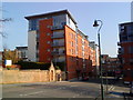
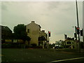
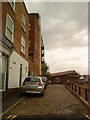
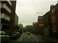
Photos of NG1 4GE


Area Information
Living in NG1 4GE means being part of a small, tightly knit residential cluster in Nottingham, England. The area has a population of 2927, creating a close-knit community with a distinct character. This postcode is home to a mix of young adults, with the most common age range being 15–29 years. The area is conveniently located near key locations, including The Nottingham Trent University, offering easy access to education and employment. Daily life in NG1 4GE is shaped by its proximity to public transport, with multiple tram stops, railway stations, and retail outlets nearby. The area is well-connected, with a broadband score of 89 and a mobile coverage score of 85, ensuring residents have reliable digital connectivity. While the population is small, the area is positioned to offer both convenience and accessibility, making it a practical choice for those seeking a balance between urban and residential living.
- Area Type
- Postcode
- Area Size
- Not available
- Population
- 2927
- Population Density
- 14168 people/km²
The property market in NG1 4GE is characterised by a low rate of home ownership, with only 10% of properties being owner-occupied. This suggests that the area is more aligned with a rental market than one dominated by long-term homeowners. The predominant accommodation type is flats, which are well-suited to the compact nature of the area and the needs of younger residents. This housing stock is likely to appeal to students and young professionals seeking affordable, easily accessible living spaces. The small size of the area means that property options are limited, and buyers should consider the broader surrounding areas for more choice. For those interested in purchasing, the market may offer opportunities for investment, particularly in rental properties. However, the low home ownership rate also indicates that the area is not traditionally a strong market for owner-occupiers.
House Prices in NG1 4GE
No properties found in this postcode.
Energy Efficiency in NG1 4GE
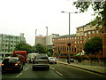
Residents of NG1 4GE have access to a range of amenities within practical reach. The area is near several retail outlets, including Co-op University of and Tesco Nottingham, providing everyday shopping convenience. Public transport options such as trams and railways ensure easy access to the city centre, while the nearby Nottingham Airport offers direct flight connections. While the data does not include specific details about parks or leisure facilities, the proximity to educational institutions and transport hubs suggests a vibrant, active lifestyle. The presence of multiple retail and transport options means that daily life in NG1 4GE is characterised by convenience and accessibility, supporting both practical needs and opportunities for social engagement.
Amenities
Schools
The area of NG1 4GE is near The Nottingham Trent University, which is a significant educational institution in the region. While there are no primary or secondary schools listed in the data, the proximity to a major university may appeal to families with older children or those seeking higher education opportunities. The lack of named schools in the immediate vicinity means that families may need to look further afield for primary and secondary schooling. However, the presence of a university can also provide a range of cultural and social opportunities for residents. For those seeking a more comprehensive educational environment, the area's location near key transport links may make it easier to access schools in surrounding areas.
| Rank | School | Type | Entry gender | Ages |
|---|
Explore more schools in this area
Go to Schools tabDemographics
The demographic profile of NG1 4GE is defined by a median age of 22, with the most common age range being young adults aged 15–29 years. This suggests a community that is largely composed of students and early career professionals. Home ownership in the area is relatively low, with only 10% of homes being owner-occupied, indicating that the majority of residents live in rental properties. The predominant accommodation type is flats, which is typical in urban areas with limited space for larger homes. The predominant ethnic group is White, reflecting the broader demographic of the region. This age profile and housing structure suggest a dynamic, transient community, with a strong focus on education and employment opportunities, particularly given the proximity to The Nottingham Trent University.
Household Size
Accommodation Type
Tenure
Ethnic Group
Religion
Household Composition
Age
Household Deprivation
NS-SEC
Explore more demographic insights in this area
Go to Demographics tabPlanning
Planning Constraints
- Flood RiskPremium
- Ramsar Wetland SitesPremium
- Area of Outstanding Natural BeautyPremium
- Protected Nature ReservePremium
- Protected WoodlandPremium