Area Overview for NG1 2FJ
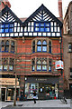
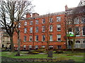
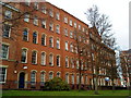
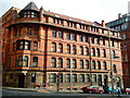
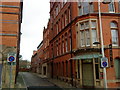
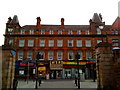
Photos of NG1 2FJ


Area Information
NG1 2FJ is a small residential postcode in Nottingham, England, with a population of 2214 people. This area is characterised by a compact, residential cluster that offers a mix of urban convenience and a close-knit community feel. The area is well-served by public transport, with tram stops, railway stations, and proximity to Nottingham Airport, making it easy to access both local and regional destinations. Daily life here is shaped by the presence of nearby retail outlets, including major supermarkets like Tesco Fletcher Gate and Sainsburys, as well as a range of other shops and services. The area’s demographic profile is dominated by young adults aged 15 to 29, which influences the social and cultural dynamics of the community. Living in NG1 2FJ means being part of a small but active postcode with a clear focus on accessibility and practical living, making it a viable choice for those seeking a balance between city life and manageable living conditions.
- Area Type
- Postcode
- Area Size
- Not available
- Population
- 2214
- Population Density
- 7554 people/km²
The property market in NG1 2FJ is characterised by a high proportion of rental properties and a predominance of flats. With only 15% of residents owning their homes, this area is not primarily an owner-occupied market but rather one that caters to tenants, particularly young adults. The availability of flats suggests a focus on compact, modern living spaces that are well-suited to individuals or small households. Given the small size of the postcode, the housing stock is limited, and buyers should consider the surrounding areas for more options. For those seeking to purchase, the market may be more competitive due to the limited supply of owner-occupied properties. This dynamic makes NG1 2FJ a viable choice for renters but a less common option for first-time buyers looking for property ownership.
House Prices in NG1 2FJ
No properties found in this postcode.
Energy Efficiency in NG1 2FJ
Residents of NG1 2FJ have access to a variety of shops and services within walking or short transit distance. The area is home to notable retail outlets such as Tesco Fletcher Gate, M&S Nottingham, and Sainsburys Nottingham, offering a range of grocery and consumer goods. The proximity to tram stops, including Lace Market and Royal Centre, and railway stations like Nottingham and Carlton, enhances the convenience of daily life. While the area does not have extensive parks or green spaces listed, the transport links and retail options contribute to a practical and accessible lifestyle. The mix of shops, dining, and transport infrastructure supports a dynamic urban environment, making NG1 2FJ a suitable choice for those who prioritise convenience and connectivity in their daily lives.
Amenities
Schools
The schools near NG1 2FJ include Nottingham College, which is a sixth-form college, and Stone Soup Academy, which is categorised as an other type of educational institution. These schools provide a range of educational opportunities for students in the area, from secondary education through to further learning. The presence of a sixth-form college indicates that higher education is accessible locally, which is beneficial for students preparing for university or vocational training. However, the lack of a comprehensive list of primary or secondary schools suggests that families may need to look beyond NG1 2FJ for a broader selection of educational options. The mix of school types reflects the area’s focus on post-secondary education and the needs of the younger adult population.
| Rank | School | Type | Entry gender | Ages |
|---|
Explore more schools in this area
Go to Schools tabDemographics
The community in NG1 2FJ is predominantly young, with the most common age range being 15 to 29 years. The median age of 22 indicates a population that is largely composed of students, young professionals, and early career individuals. Home ownership in the area is relatively low, with only 15% of residents owning their homes. This suggests that the majority of the housing stock is occupied by renters, and the accommodation type is primarily flats, which reflects a trend towards urban living in this small postcode. The predominant ethnic group is White, which aligns with broader demographic patterns in the region. The young age profile of the population influences the local culture and lifestyle, with a focus on social engagement and access to education and employment.
Household Size
Accommodation Type
Tenure
Ethnic Group
Religion
Household Composition
Age
Household Deprivation
NS-SEC
Explore more demographic insights in this area
Go to Demographics tabPlanning
Planning Constraints
- Flood RiskPremium
- Ramsar Wetland SitesPremium
- Area of Outstanding Natural BeautyPremium
- Protected Nature ReservePremium
- Protected WoodlandPremium