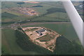
Area Overview for Newton (North Northamptonshire)
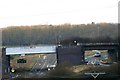
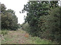
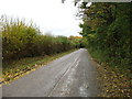
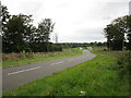
Photos of Newton (North Northamptonshire)


Area Information
Newton (North Northamptonshire) is a compact built-up area spanning 22 hectares, serving as a quiet residential hub in the region. The area’s population skews older, with a median age of 70, reflecting a community that may prioritise stability and proximity to essential services. Despite its modest size, Newton offers practical access to nearby retail, transport, and leisure options. Residents benefit from nearby railway stations at Kettering and Corby, as well as a bus interchange, which connect them to broader regional networks. The area’s low crime risk score of 84 suggests a safer environment, though it remains a small, tightly knit community. For those seeking a place with minimal urban sprawl but sufficient connectivity, Newton balances simplicity with practicality. Its proximity to supermarkets like Morrisons and Asda, combined with a home ownership rate of 76%, indicates a mix of long-term residents and those invested in local property. Daily life here likely revolves around nearby amenities and the rhythms of a slower-paced, community-focused lifestyle.
- Area Type
- Built Up Area 250
- Area Size
- 22.0 hectares
- Population
- Not available
- Population Density
- Not available
Residents of Newton (North Northamptonshire) have access to a range of nearby amenities, including five retail outlets such as Morrisons Daily Corby Gateway, Aldi Oakley, and Asda Kettering. These shops provide essential services and convenience for daily errands. The area’s transport links, including Kettering and Corby railway stations and a bus interchange, facilitate travel to larger towns and cities. While there is no mention of parks or leisure facilities in the data, the presence of supermarkets and transport hubs suggests a focus on practicality over expansive recreational options. The local retail landscape supports a basic lifestyle, with shops positioned to meet everyday needs. For those prioritising ease of access to shopping and transport, Newton offers a straightforward, no-frills approach to daily living.
Amenities
Schools
| Rank | A + A* % | School | Type | Entry gender | Ages |
|---|
Explore more schools in this area
Go to Schools tabDemographics
The population of Newton (North Northamptonshire) has a median age of 70, with the most common age range encompassing all demographics. This suggests a community with a significant proportion of older residents, which may influence local services and social dynamics. Home ownership is high, at 76%, indicating a stable housing market where most residents own their properties rather than rent. The data does not specify household composition or accommodation types, but the overall figures imply a settled population with long-term residency patterns. There is no information on ethnic diversity or religious composition, but the absence of such data does not detract from the area’s distinct characteristics. The high home ownership rate may contribute to a sense of permanence, though it also means the housing stock is likely older and less dynamic in terms of turnover. For prospective buyers, this demographic profile suggests a community with a focus on continuity and low mobility.
Household Size
Accommodation Type
Tenure
Ethnic Group
Religion
Household Composition
Age
Household Deprivation
NS-SEC
Explore more demographic insights in this area
Go to Demographics tabPlanning
Planning Constraints
- Crime RiskLocked