Area Overview for Newbold Verdon with Desford and Peckleton Ward
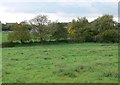
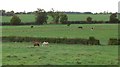
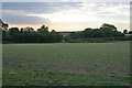
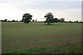
Photos of Newbold Verdon with Desford and Peckleton Ward
Area Information
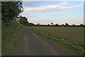
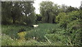
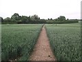
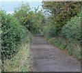
Living in Newbold Verdon with Desford and Peckleton Ward offers a distinctly rural experience characterised by low density and open space. This district forms part of the Borough Unitary Ward structure within England, covering a geographic area of 44.0 km². With a population of just 2090 people, the community maintains a very low population density of 1595 people per km², resulting in spacious surroundings rather than a crowded urban environment. Residents enjoy a quiet lifestyle where the emphasis is on tranquility and proximity to natural settings. The area is not dominated by high-rise developments or dense terraced housing typical of larger towns. Instead, the setting reflects a settled community where neighbours know each other well due to the small resident count. You will find a neighbourhood that feels more like a village extension than a large municipality. Daily life involves easier access to local green spaces and less exposure to the noise and congestion associated with major city centres. The compact size of the ward ensures that distances between local amenities and residences remain short. Potential buyers seeking a peaceful retreat should appreciate how the physical layout supports a slow-paced existence. You are trading urban convenience for the benefit of a spacious, uncontested environment. The area stands out for its manageable scale and its integration into the wider rural landscape of the region. It is a place where you know exactly how many people share your postcode.
- Area Type
- District Borough Unitary Ward
- Area Size
- 44.0 km²
- Population
- 2090
- Population Density
- 1595 people/km²
Demographics
The community within Newbold Verdon with Desford and Peckleton Ward is defined by a very specific age profile and high rates of home ownership. The median age stands at 70 years, indicating a population skewed heavily towards retirees and older adults. This demographic reality shapes the local culture, with services and facilities likely catering to the needs of an elderly populace. The most common age range recorded simply lists "Age: Total," suggesting a broad distribution among the remaining residents without a singular youthful peak. Home ownership is exceptionally high at 81%, meaning that the vast majority of households have bought their properties outright or are paying a mortgage. This statistic implies a stable, long-term community where residents are less likely to move frequently. You are entering an area where people have put down roots for decades. Accommodation types and diverse household compositions are noted in the data, creating a mix of living situations within the ward. The low population density complements this demographic picture, as spacious homes suit those looking for peace and quiet. Families with very young children are less likely to be the dominant group, as there are no specific statistics highlighting a young parent majority. Instead, the social fabric revolves around older residents enjoying their independence. If you prefer a neighbourhood where the noise of teenagers is minimal, this area aligns perfectly with that preference. The high ownership rate also suggests a local economy driven by property stability rather than transient renting. Every resident contributes to a demographic environment focused on mature living standards. You will find a community where the average person has lived in one place for many years.
Household Size
Accommodation Type
Tenure
Ethnic Group
Religion
Household Composition
Age
Household Deprivation
NS-SEC
Explore more demographic insights in this area
Go to Demographics tabPlanning
Planning Constraints
- Flood RiskPremium
- Ramsar Wetland SitesPremium
- Area of Outstanding Natural BeautyPremium
- Protected Nature ReservePremium
- Protected WoodlandPremium
- Crime RiskPremium