Area Overview for New Mills West Ward
Photos of New Mills West Ward

Area Information
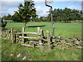
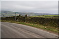
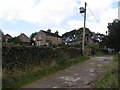
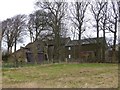
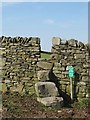
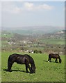
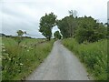
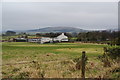
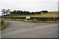
New Mills West Ward occupies 4.9 square kilometres of land within High Peak Borough Council in Derbyshire. This district council ward lies on the north-western edge of the Peak District National Park. The town sits at the confluence of the River Goyt and River Sett, roughly eight miles south-east of Stockport and thirteen miles from Manchester. You will find yourself bordering Cheshire and Greater Manchester, placing you in the East Midlands region. Historically, this location served as a hub for coal mining and cotton spinning, industries supported by the Peak Forest Canal and three railway lines. Today, your daily life is shaped by the A6 trunk road, which connects London to Carlisle via Manchester. The landscape includes the Torrs, a deep gorge linking the two rivers, alongside the Torrs Millennium Walkway. Living in New Mills West Ward means accessing nature adjacent to industrial history, with specific landmarks like Torr Vale Mill standing as Grade II* listed structures. The ward sits within the western portion of New Mills, offering a setting derived from its manufacturing past while benefiting from proximity to major cities. Your home front includes views of these historic waterways and the distinct geography defined by the Goyt valley.
- Area Type
- District Borough Unitary Ward
- Area Size
- 4.9 km²
- Population
- Not available
- Population Density
- Not available
Demographics
The community within New Mills West Ward reflects an established residential pattern with significant local ownership. The median age in the ward is 70 years, indicating a population skewed towards older residents. Most households consist of individuals or couples rather than large families with young children, consistent with the age profile. You will find that 74% of homes are owner-occupied, meaning the majority of people living here own their property outright or with a mortgage. The remaining quarter of households likely involve tenants or those sharing accommodation. Data shows no active Ramsar wetland sites, Areas of Outstanding Natural Beauty, or protected nature reserves within this ward's boundaries. While specific statistics on predominant ethnic groups or religious affiliation are not detailed in the provided data, the historical record notes the area was once a Methodist stronghold. The ward represents a stable demographic where long-term residents form the core of the community. Living in New Mills West Ward involves an environment where the older population dominates the social fabric. This age distribution suggests a quieter, perhaps more settled neighbourhood atmosphere compared to younger urban districts. The housing stock and ownership levels confirm this is not a transient rental market.
Household Size
Accommodation Type
Tenure
Ethnic Group
Religion
Household Composition
Age
Household Deprivation
NS-SEC
Explore more demographic insights in this area
Go to Demographics tabPlanning
Planning Constraints
- Flood RiskPremium
- Ramsar Wetland SitesPremium
- Area of Outstanding Natural BeautyPremium
- Protected Nature ReservePremium
- Crime RiskPremium