Area Overview for Nevile & Langar Ward
Photos of Nevile & Langar Ward
Area Information
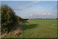
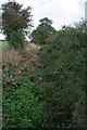
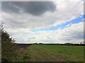
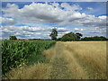
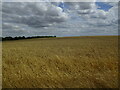
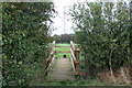
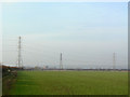
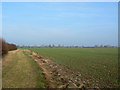
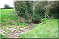
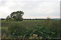
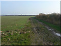
Nevile & Langar Ward covers a significant expanse of 58.3 km² within the borough. The sheer size of this ward suggests a landscape that likely varies considerably from one end to the other, rather than offering a uniform urban streetscape. Living in Nevile & Langar Ward involves navigating a large territory where daily routines may require longer journeys between specific points compared to smaller, densely packed towns. The area defines itself not by recent development or rapid growth, but by established patterns of settlement over a wide footprint. You can expect a neighbourhood that has evolved organically across more than 58 square kilometres, offering ample space but potentially limiting the density of immediate local amenities. This district borough unitary ward represents a substantial commitment for anyone choosing to reside here. The scale indicates a community where isolation between homes might be greater than in city centres, yet it also provides room for varied environments within the same administrative boundary. Prospective buyers must consider the implications of covering such a large area for their commute and social life. The distinctiveness of Nevile & Langar Ward lies in this expansive nature, which shapes the rhythm of daily life for everyone called home to this location. It is a place defined by its broad boundaries rather than specific, tightly clustered landmarks.
- Area Type
- District Borough Unitary Ward
- Area Size
- 58.3 km²
- Population
- Not available
- Population Density
- Not available
Demographics
The community in Nevile & Langar Ward has settled into a very specific profile with a median age of 70. This figure starkly differentiates the area from younger city districts, indicating a population dominated by older residents who have chosen to stay or have moved to larger homes. Age: Total represents the overarching demographic reality where the vast majority of households contain adults well past retirement age. Living in Nevile & Langar Ward means joining a community where the primary residents are senior citizens, creating a quiet, perhaps slower-paced environment compared to districts filled with families and young professionals. Home ownership stands at an impressive 87%, marking this as a territory almost entirely free of rental uncertainty. This high rate of ownership reflects a generation that has built equity over decades and now prioritises stability over flexibility. With total household composition and accommodation type data pointing toward established living arrangements, you are looking at a static population rather than a transient one. The people calling Nevile & Langar Ward home are committed to their addresses, resulting in a neighbourhood where neighbourly ties have had time to develop over many years. The data shows total figures for predominant ethnic groups and religion, confirming a demographic that is historically rooted and demographically uniform. There is minimal movement of people in or out of the ward, further cementing the status quo. For a buyer, this translates to a predictable community dynamic where the social fabric remains steady. The demographic profile of Nevile & Langar Ward is one of mature stability, where the residents know one another and the character of the streets has remained consistent for a very long time.
Household Size
Accommodation Type
Tenure
Ethnic Group
Religion
Household Composition
Age
Household Deprivation
NS-SEC
Explore more demographic insights in this area
Go to Demographics tabPlanning
Planning Constraints
- Flood RiskPremium
- Ramsar Wetland SitesPremium
- Area of Outstanding Natural BeautyPremium
- Protected Nature ReservePremium
- Protected WoodlandPremium
- Crime RiskPremium