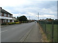
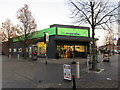
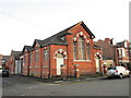
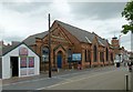
Area Overview for Netherfield Ward
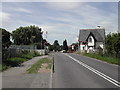
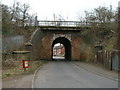
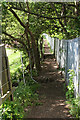
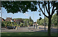
Photos of Netherfield Ward

Area Information
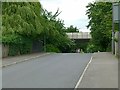
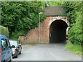
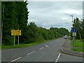
Living in Netherfield Ward offers a stark reality for prospective homebuyers due to significant environmental hazards. This district borough unitary ward covers just 1.4 km² yet presents a severe challenge regarding flood safety. The area carries a critical risk level for flooding, covering a high percentage of its land. This is the most pressing factor when considering your daily life here, as water levels can impact homes frequently. Despite this danger, there are no planning constraints from protected nature reserves, Ramsar wetland sites, or Areas of Outstanding Natural Beauty. You will find no restricted woodland or protected nature reserves limiting development within the ward boundaries. The median age of residents sits at 70 years, indicating a mature community settled in properties that have weathered many decades. Home ownership is established here with five in ten residents owning their homes. While the area lacks major heritage designations, the ownership rate suggests a long-term community presence. Safety from crime remains a strength, with rates below the national average. However, you must weigh the low crime figures against the critical flood classification before making any decisions. The small size of this 1.4 km² district means risks and amenities are concentrated closely together.
- Area Type
- District Borough Unitary Ward
- Area Size
- 1.4 km²
- Population
- Not available
- Population Density
- Not available
Demographics
The community within Netherfield Ward is distinctly older, defined by a median age of 70 years. Most residents fall into broad age ranges rather than a booming youth demographic, creating a quiet, settled atmosphere. Fifty-six per cent of households own their homes, a rate that points to a stable population with deep roots in the area. The remaining residents likely rent from local landlords or housing associations. Although specific data on household composition is not broken down further, the ownership rate suggests families or couples rather than transient renters. The ward has passed all planning constraint checks, meaning there are no protected nature reserves, Areas of Outstanding Natural Beauty, or Ramsar wetland sites dictating where new homes can be built. This absence of planning restrictions contrasts sharply with the demographic profile, which shows little recent influx of young families. The population density within this 1.4 km² space is consistent with an area dominated by older adults living in existing stock. You will encounter a neighbourhood where lifestyle revolves around convenience rather than energy-intensive development. The lack of specified predominant ethnic groups noted in the data means the community appears homogeneous based on available metrics.
Household Size
Accommodation Type
Tenure
Ethnic Group
Religion
Household Composition
Age
Household Deprivation
NS-SEC
Explore more demographic insights in this area
Go to Demographics tabPlanning
Planning Constraints
- Flood RiskPremium
- Ramsar Wetland SitesPremium
- Area of Outstanding Natural BeautyPremium
- Protected Nature ReservePremium
- Protected WoodlandPremium
- Crime RiskPremium