Area Overview for Navenby & Brant Broughton Ward
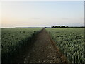
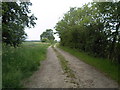
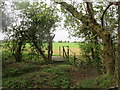
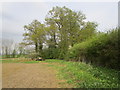
Photos of Navenby & Brant Broughton Ward
Area Information
Living in Navenby & Brant Broughton Ward means residing within a district council ward situated in the East Midlands region of England. This area encompasses the villages of Navenby and Brant Broughton and lies at coordinates 53.084856, -0.585330 within the modern district of North Kesteven. You are looking at a locality that covers an area size of 86.0 km², offering a defined space for daily life. The ward operates under North Kesteven District Council, providing the framework for local governance and services. For those interested in the geography of the region, specific mapping data places these villages in a known location within the broader English countryside. If you are researching homes in Navenby & Brant Broughton Ward, you are examining a specific administrative division with clear boundaries. The coordinates pinpoint the centre of activity for residents in this rural setting. Understanding the exact location helps when planning commutes or accessing nearby towns. The area is defined by its status as a ward, which groups these specific parishes together for political representation. You will find that the geography supports a set lifestyle distinct from more urban centres. The combination of village life and council ward status defines the structure of community here.
- Area Type
- District Borough Unitary Ward
- Area Size
- 86.0 km²
- Population
- Not available
- Population Density
- Not available
Demographics
You will find that the community in Navenby & Brant Broughton Ward has a distinct age profile with a median age of 70. This figure indicates that older residents form the core of the population. The demographic data identifies the most common age range as Total, reflecting the overall composition of the ward. With a median age reaching 70, you should expect a neighbourhood where many households are occupied by retirees. This age distribution shapes the social environment and the type of services available to the inhabitants. Regarding home ownership, the data shows that 77% of the population own their homes. This high percentage suggests a stable community with deep roots in the local area. Most households fall into the ownership category rather than the private rental sector. The predominance of owner-occupiers often creates a sense of continuity, even without specific data on household composition breakdowns. While specific details on ethnic groups and religious affiliations are not itemised in the current report, the ownership rate remains a clear indicator of residency patterns. When you consider living in Navenby & Brant Broughton Ward, the statistics point toward a settled demographic where families and retirees have purchased their properties over time. The high rate of home ownership supports a stable social fabric.
Household Size
Accommodation Type
Tenure
Ethnic Group
Religion
Household Composition
Age
Household Deprivation
NS-SEC
Explore more demographic insights in this area
Go to Demographics tabPlanning
Planning Constraints
- Flood RiskPremium
- Ramsar Wetland SitesPremium
- Area of Outstanding Natural BeautyPremium
- Protected Nature ReservePremium
- Crime RiskPremium