Area Overview for Naseby
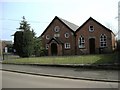
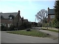
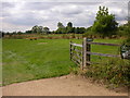
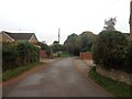
Photos of Naseby

Area Information
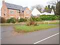
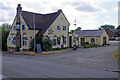
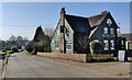
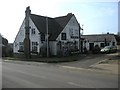
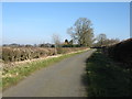
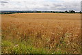
Naseby stands as a distinct built-up area within England, covering twenty-nine point six hectares. Residents here experience daily life in a compact settlement that balances residential living with essential local access. The area functions as a traditional community where proximity to key services defines the neighbourhood character. You can navigate the locality on foot or by vehicle, enjoying a setting that prioritises established infrastructure over rapid expansion. This environment appeals to those seeking a grounded location with clear boundaries between public and private spaces. The community supports a range of housing styles suited to long-term settlement. Living in Naseby means participating in a area where past development patterns shape the current streetscape. You will move through streets lined with properties that have stood the test of time. The overall footprint remains modest, encouraging a sense of place that larger towns often lack. This built-up zone offers a stable backdrop for family life and retirement alike.
- Area Type
- Built Up Area 250
- Area Size
- 29.6 hectares
- Population
- Not available
- Population Density
- Not available
Amenities
Schools
Families living in Naseby benefit from two primary education options situated directly within the local landscape. Naseby Church of England Primary School serves the younger generation as a dedicated primary institution. The area also hosts Naseby Church of England Primary Academy, which holds a good Ofsted rating. This dual provision offers parents choice between a standard primary school and an academy framework. Both institutions focus on early childhood development within the immediate vicinity of your home. The mix of school types provides flexibility for families regarding educational philosophy and governance structure. You do not need to travel far for core primary education. The presence of these schools supports the area's suitability for younger families despite the older median age. Educational facilities are fully integrated into the daily routine of residents in Naseby.
| Rank | School | Type | Entry gender | Ages |
|---|
Explore more schools in this area
Go to Schools tabDemographics
The community profile in Naseby reflects a mature demographic with a median age of exactly seventy. Most residents fall into the older age bracket, indicating a population that has settled long-term rather than a transient workforce. Seventy-nine per cent of households own their homes, creating a community defined by stability and permanence. This high ownership rate suggests the area is not primarily a rental market but rather a destination for established families or retirees. The household composition aligns with this ownership trend, reinforcing the image of a settled neighbourhood. Homeowners form the backbone of local society, investing heavily in the maintenance and upkeep of their properties. You will find a resident base that values continuity over quick turnover. This demographic reality shapes local governance, community groups, and the pace of development. The area caters specifically to those who have achieved financial independence and seek a manageable environment.
Household Size
Accommodation Type
Tenure
Ethnic Group
Religion
Household Composition
Age
Household Deprivation
NS-SEC
Explore more demographic insights in this area
Go to Demographics tabPlanning
Planning Constraints
- Crime RiskPremium