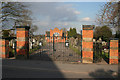
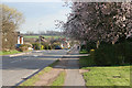
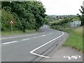
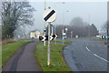
Area Overview for Mountsorrel
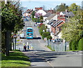
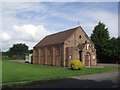
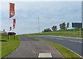
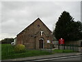
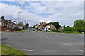
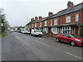
Photos of Mountsorrel

Area Information
Mountsorrel is a built-up area covering 3.6 km², situated in the English Midlands. It functions as a distinct residential settlement rather than a sprawling city or village. Residents here enjoy a settled lifestyle within a relatively compact footprint, which typically means short travel distances to local necessities. The area is characterised by its compact nature, making it ideal for those who prefer proximity to their neighbourhood amenities. Daily life revolves around being close to retail outlets, transport links, and community spaces without the traffic congestion of larger urban centres. The geography of Mountsorrel supports a self-contained existence where most daily needs can be met locally. You will find a community where the distance to the high street or train station is measured in minutes rather than hours. This setup suits individuals seeking a quiet yet connected environment. The area balances the convenience of accessibility with the calm of a smaller settlement. Whether you are walking your dog or visiting a local shop, the small-scale size of Mountsorrel ensures you remain within reach of your home.
- Area Type
- Built Up Area 250
- Area Size
- 3.6 km²
- Population
- Not available
- Population Density
- Not available
Residents of Mountsorrel enjoy a range of amenities immediately within practical reach, reducing the need for long journeys to the city. The retail sector is well-supported with five notable shops, including Co-op Mountsorrel, Co-op Rothley, and Waitrose Mountsorrel. These name-brand retailers ensure you can purchase groceries and daily essentials without leaving the immediate vicinity. Transport links extend beyond just road travel, as there are five metro-style stations and five railway stations listed nearby. Specific rail hubs include Sileby Railway Station, Barrow upon Soar Railway Station, and Syston Railway Station, providing options for commuting further afield. Leisure is catered for by the Great Central Railway, which offers cultural and recreational opportunities close to home. additional transport options include those serving Rothley, Quorn & Woodhouse. This network density means you have multiple ways to travel depending on your destination. The presence of Waitrose alongside Co-op stores suggests a focus on quality local shopping. You can combine a shopping run with a train journey efficiently. The lifestyle is defined by accessibility to both immediate retail needs and broader transport networks.
Amenities
Schools
Families considering Mountsorrel have several educational options within practical reach, though the school mix leans heavily towards primary and special education. Rothley Church of England Primary School is located nearby and holds a Good Ofsted rating. This institution provides a cornerstone of local education for younger children. Christ Church & Saint Peter's Cofe Primary School is the second primary option with a matching Good Ofsted rating, ensuring a high standard of primary education. Both primary schools offer a secure foundation for young learners in the community. Homefield College is also listed as a nearby institution, but its classification as a special school indicates it serves specific educational needs rather than being a standard secondary provider. The absence of mainstream secondary schools in the immediate data set means families may need to look beyond Mountsorrel for high school education. You should verify travel times for older students to outside secondary establishments. The current school landscape supports young families with reliable primary choices, but it does not offer a complete independent ecosystem from nursery to sixth form within the listed nearby options.
| Rank | School | Type | Entry gender | Ages |
|---|
Explore more schools in this area
Go to Schools tabDemographics
The community in Mountsorrel displays a clearly defined age profile with a median age of 70. This figure indicates that the population consists predominantly of older residents. The demographic data points to a settlement that has historically retained its elderly population rather than attracting a young, family-dominated cohort. Home ownership stands at 76 per cent, a figure that reinforces the stability of the long-term residents living here. Such a high rate of ownership suggests that most households have lived in their properties for significant periods, likely contributing to the older age median. The household composition and accommodation type data reflect a community built around established rather than transient living arrangements. This demographic structure creates a specific social fabric where neighbours are likely to know one another across generations. You should expect an environment where change happens slowly. The population does not fluctuate rapidly, offering a predictable community atmosphere. For potential buyers, understanding that this area attracts buyers seeking permanence rather than a turn-over rate is essential. The 76 per cent ownership rate amidst a 70-year-old median age paints a picture of a retirement-focused or mature settlement.
Household Size
Accommodation Type
Tenure
Ethnic Group
Religion
Household Composition
Age
Household Deprivation
NS-SEC
Explore more demographic insights in this area
Go to Demographics tabPlanning
Planning Constraints
- Crime RiskPremium