Area Overview for Moulton, Weston and Cowbit Ward
Photos of Moulton, Weston and Cowbit Ward

Area Information
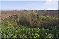
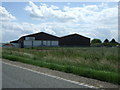
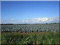
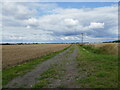
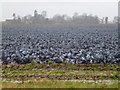
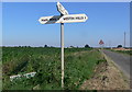
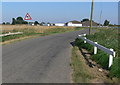
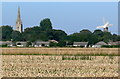
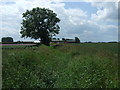
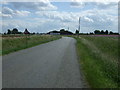
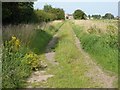
Living in Moulton, Weston and Cowbit Ward offers a distinctly rural experience centred on the village of Moulton. This electoral ward sits within South Holland District Council in Lincolnshire and covers an area of 87.2 km². The landscape is defined by low population density, meaning daily life unfolds across a vast expanse of land relative to the number of residents. You will find the ward includes the primary settlement of Moulton, located on the A151 and B1537 roads, which sit approximately 5 miles east of Spalding and 3.5 miles west of Holbeach. Surrounding this hub are the Fenland fringes of Moulton Chapel, Moulton Seas End, Moulton Eaugate, Weston, and Cowbit. The geography places the area near coordinates 52.791°N, -0.079°W, anchoring it centrally within its parish. Your daily routine will rely heavily on vehicle access, as the ward is described as rural with high importance for car ownership. Former transport links like the Moulton railway station, which closed to passengers in 1959, remain historically significant but offer no current rail services. Instead, you must navigate via the A151 and B1537 to reach broader connections. The area possesses deep historical roots, marked by landmarks such as All Saints' Church, often called the "Queen of the Fens", and the Grade I listed Moulton Windmill, built in 1822. Life here feels detached from urban pace, characterised by wide-open spaces and a sense of history stretching back to the 16th century with the founding of Moulton Grammar School.
- Area Type
- District Borough Unitary Ward
- Area Size
- 87.2 km²
- Population
- Not available
- Population Density
- Not available
Demographics
The community in Moulton, Weston and Cowbit Ward is demographically distinct due to its age profile. Residents here have a median age of 70 years, indicating an exceptionally elderly population compared to national averages. This demographic skew suggests the area is a retirement destination or a place where older generations choose to retire rather than raise families. You are joining a settlement where the most common age group is recorded simply as "Total", a data classification that highlights the dominance of older residents over younger working-age adults. Home ownership in this ward stands at 79%, reflecting a strong preference for owning property rather than renting. This high rate aligns with the older age profile, as older adults are statistically more likely to own their homes outright or be in the process of doing so. The low population density of 0.78 persons per hectare across an area covering 8,693 hectares further emphasises the spacious nature of the accommodation. Residents are spread thinly across this landscape, likely living in detached or semi-detached bungalows and houses suited to an older lifestyle. With a population of approximately 7,781 recorded in 2021, the ward maintains a very quiet character. You do not experience the density of town centres or the noise of close-knit urban communities here. Instead, you inhabit an environment defined by space, distance between neighbours, and a static population structure.
Household Size
Accommodation Type
Tenure
Ethnic Group
Religion
Household Composition
Age
Household Deprivation
NS-SEC
Explore more demographic insights in this area
Go to Demographics tabPlanning
Planning Constraints
- Flood RiskPremium
- Area of Outstanding Natural BeautyPremium
- Protected WoodlandPremium
- Crime RiskPremium