Area Overview for Morcott
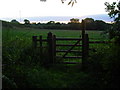
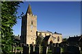
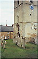
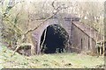
Photos of Morcott


Area Information
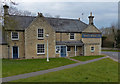
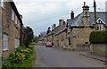
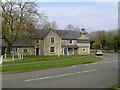
Morcott presents itself as a distinct built-up area covering just 23.5 hectares in the English countryside. Living in Morcott means residing in a defined community rather than a sprawling urban centre. The compact size suggests a close-knit environment where distances are manageable without reliance on complex transport networks. You will find this settlement offers a quiet alternative to larger towns, defined by its physical boundaries and intimate scale. The area accommodates a demographic that has chosen this specific footprint for their home life. Daily life here revolves around the immediate surroundings of the 23.5-hectare footprint. There are no large industrial zones or high-density estates to buffer the character of the place. Instead, the built-up nature creates a unified residential zone. Prospective buyers should consider how this specific land size influences their sense of space and community interaction. The location offers a concentrated living experience where everything is within a short walk or drive. This definition of the area sets the stage for the specific lifestyle found within these historic limits.
- Area Type
- Built Up Area 250
- Area Size
- 23.5 hectares
- Population
- Not available
- Population Density
- Not available
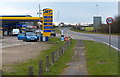
Daily life in Morcott relies on amenities found just beyond the immediate settlement borders. Within practical reach, you have access to four retail locations including Spar - Adams and Co-op Uppingham. These specific stores provide essential groceries and daily necessities without requiring a long journey into Uppingham. You can stock up on food, phone top-ups, and basic household items from these named venues. Budgens Uppingham also operates nearby, offering an additional supermarket option for those preferring a larger range of goods. The concentration of these four outlets ensures that the essential retail needs of Morcott residents are met with minimal travel. This practical arrangement supports a lifestyle where spontaneous shopping trips are feasible but may require a short drive. The character of your weekly shopping is defined by these few, reliable high street names. Dining and leisure options are not detailed in the immediate data, so your routine will focus heavily on these retail hubs. The convenience of Spar, Co-op, and Budgens anchors the practical side of living in this area.
Amenities
Schools
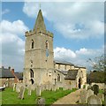
The educational landscape near Morcott is centred around Morcotte Hall School. This independent institution serves as the primary educational facility for children living in the area. You will find only one school listed within your reach, which limits the choice available to families wishing to enroll. The presence of an independent school indicates that some residents prefer private education over the state system. However, the absence of other options means you must consider travel times or alternative catchment areas for different age groups. Living in Morcott requires you to weigh the benefits of this single independent option against the lack of nearby state school choices. The school type is explicitly independent, which carries different fees and admission criteria compared to comprehensive local schools. No other academic institutions appear in the data for the immediate vicinity. Families should plan their housing search with this singular educational option in mind. The limited school selection reflects the small size of the built-up area.
| Rank | School | Type | Entry gender | Ages |
|---|
Explore more schools in this area
Go to Schools tabDemographics
The community in Morcott reflects a settled population with very few people under working age. The median age here stands at 70 years, indicating a significant concentration of older residents. Living in Morcott means joining a society where the majority of the population is approaching or has reached retirement age. You will find that the total household composition supports this older demographic profile. Home ownership levels are exceptionally high at 76% of households. This figure shows that most people who live here own their properties outright or have significant equity. There is no evidence of a large student influx or young professional rental market driving the local numbers. The high ownership rate points to long-term residents who may be planning to stay until the end of their lives. This stability shapes the local services and community facilities to meet the needs of seniors. The demographic data paints a clear picture of a retiring town rather than a growing young hub. Buyers should expect a neighbourly, mature environment with cabin-force residents.
Household Size
Accommodation Type
Tenure
Ethnic Group
Religion
Household Composition
Age
Household Deprivation
NS-SEC
Explore more demographic insights in this area
Go to Demographics tabPlanning
Planning Constraints
- Crime RiskPremium