Area Overview for MK19 7JA
Photos of MK19 7JA
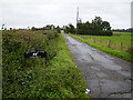
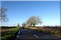
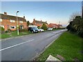
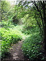
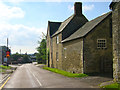
6 photos from this area
Area Information
Key information about the MK19 7JA including its size, population, and administrative classification.
- Area Type
- Postcode
- Area Size
- 49.0 hectares
- Population
- 1406
- Population Density
- 153 people/km²
House Prices in MK19 7JA
30
Properties
£583,155
Average Sold Price
£214,995
Lowest Price
£1,850,000
Highest Price
Showing 30 properties
| Address | Type | Beds | Baths | Last Sale Price | Last Sale Date | |
|---|---|---|---|---|---|---|
| 2B Stratford Road, Cosgrove, MK19 7JA | Terraced | 4 | 4 | £335,000 | Sep 2025 | |
| 6B Stratford Road, Cosgrove, MK19 7JA | Terraced | 4 | - | £435,000 | Jul 2025 | |
| Yew Tree House, 3A Stratford Road, Cosgrove, MK19 7JA | Detached | 6 | 5 | £1,675,000 | Dec 2023 | |
| 7 Stratford Road, Cosgrove, MK19 7JA | Terraced | 2 | 1 | £270,000 | Mar 2023 | |
| 11 Stratford Road, Cosgrove, MK19 7JA | Retail | 4 | 2 | £525,000 | Feb 2023 | |
| 5 Stratford Road, Cosgrove, MK19 7JA | house | - | - | £538,800 | Sep 2022 | |
| 6C Stratford Road, Cosgrove, MK19 7JA | Semi-detached | 4 | 2 | £400,000 | Aug 2022 | |
| The Old Dower House, 16 Stratford Road, Cosgrove, MK19 7JA | Detached | - | - | £1,510,000 | Jun 2021 | |
| 12 Stratford Road, Cosgrove, MK19 7JA | Detached | 3 | 1 | £450,000 | Jul 2018 | |
| Greystones, 1 Stratford Road, Cosgrove, MK19 7JA | Detached | - | - | £415,000 | Oct 2017 |
Page 1 of 3
Energy Efficiency in MK19 7JA
Amenities
Schools
| Rank | School | Type | Entry gender | Ages |
|---|
Explore more schools in this area
Go to Schools tabDemographics
Household Size
Two person
most common
Accommodation Type
Houses
most common
Tenure
74
majority
Ethnic Group
White
most common
Religion
N/A
most common
Household Composition
N/A
most common
Age
47
median
Adults (30-64 years)
most common
Household Deprivation
N/A
with no deprivation
NS-SEC
46
in Lower managerial occupations
Explore more demographic insights in this area
Go to Demographics tabPlanning
Planning Constraints
- Flood RiskPremium
- Ramsar Wetland SitesPremium
- Area of Outstanding Natural BeautyPremium
- Protected Nature ReservePremium
- Protected WoodlandPremium