Area Overview for MK19 6BT
Photos of MK19 6BT
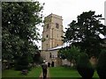

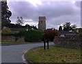
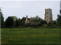

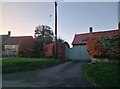
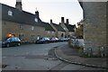
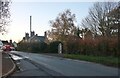
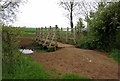
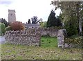
19 photos from this area
Area Information
Key information about the MK19 6BT including its size, population, and administrative classification.
- Area Type
- Postcode
- Area Size
- 3.1 hectares
- Population
- 2751
- Population Density
- 152 people/km²
House Prices in MK19 6BT
22
Properties
£415,494
Average Sold Price
£130,000
Lowest Price
£1,179,000
Highest Price
Showing 22 properties
| Address | Type | Beds | Baths | Last Sale Price | Last Sale Date | |
|---|---|---|---|---|---|---|
| The Reading Room, 50 Cross Tree Road, Wicken, MK19 6BT | Semi-detached | 3 | 1 | £390,000 | Jun 2024 | |
| The Old Bakery, 36 Cross Tree Road, Wicken, MK19 6BT | Detached | 5 | 3 | £1,179,000 | Nov 2022 | |
| 24 Cross Tree Road, Wicken, MK19 6BT | Semi-detached | 2 | 2 | £275,000 | Mar 2021 | |
| 6 Cross Tree Road, Wicken, MK19 6BT | Bungalow | - | - | £395,000 | Aug 2018 | |
| The Old School, 12 Cross Tree Road, Wicken, MK19 6BT | Detached | 3 | 1 | £565,000 | Aug 2017 | |
| 18 Cross Tree Road, Wicken, MK19 6BT | Semi-detached | - | - | £130,000 | Feb 2009 | |
| The Forge, 46 Cross Tree Road, Wicken, MK19 6BT | Semi-detached | - | - | £249,950 | Feb 2000 | |
| Giles Cottage, 54 Cross Tree Road, Wicken, MK19 6BT | Cottage | 3 | 1 | £140,000 | May 1995 | |
| 42 Cross Tree Road, Wicken, MK19 6BT | Detached | - | - | - | - | |
| Walnut Tree Cottage, 44 Cross Tree Road, Wicken, MK19 6BT | Detached | - | - | - | - |
Page 1 of 3
Energy Efficiency in MK19 6BT
Amenities
Schools
| Rank | School | Type | Entry gender | Ages |
|---|
Explore more schools in this area
Go to Schools tabDemographics
Household Size
Family (3-5 people)
most common
Accommodation Type
Houses
most common
Tenure
82
majority
Ethnic Group
White
most common
Religion
N/A
most common
Household Composition
N/A
most common
Age
47
median
Adults (30-64 years)
most common
Household Deprivation
N/A
with no deprivation
NS-SEC
45
in Lower managerial occupations
Explore more demographic insights in this area
Go to Demographics tabPlanning
Planning Constraints
- Flood RiskPremium
- Ramsar Wetland SitesPremium
- Area of Outstanding Natural BeautyPremium
- Protected Nature ReservePremium
- Protected WoodlandPremium