Area Overview for Mickleover Ward
Photos of Mickleover Ward
Area Information
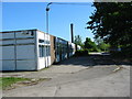
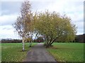
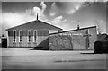
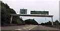
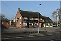
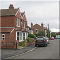
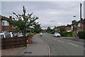
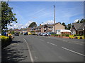
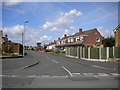
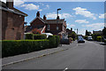
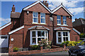
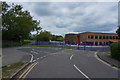
Living in Mickleover Ward offers a defined suburban experience within one of Derby's largest expanding suburbs. This village and ward covers 4.4 square kilometres and sits approximately two miles west of Derby city centre. You will find yourself in an area that functions as a distinct residential hub while remaining close to the city. Historically, this location was a parish that merged into the city in 1968, and today it is popular with business commuters and sports teams staying at the Mickleover Court Hotel. The area retains a village feel despite ongoing housing developments. The village centre provides essential amenities, including pubs and smaller shops, alongside a Tesco supermarket for daily needs. Residents benefit from key infrastructure along the Uttoxeter Road, commonly known as the B5020, and the Mickleover bypass which carries the A516 and A38 routes. Although the line formerly served by the Mickleover station is gone, replaced by the modern A38 trunk road, the location maintains strong road connectivity to the wider region. The ward's layout allows for a mix of older village parts and newer developments, creating a practical setting for life on the fringe of the city.
- Area Type
- District Borough Unitary Ward
- Area Size
- 4.4 km²
- Population
- 4173
- Population Density
- 950 people/km²
Demographics
Just over 4,000 people currently live within the Mickleover Ward boundaries, which is relatively small for a suburban ward of this size. The population is dispersed across the 4.4 square kilometre area, resulting in a density of roughly 950 people per square kilometre. An unusual demographic feature of this neighbourhood is the median age, which stands at an exceptionally high figure of 70 years. This indicates a community dominated by older residents rather than young families or students. When you consider who lives here, you are looking at an area where stability is the norm. Home ownership is extremely high, with 82 per cent of households in Mickleover Ward owning their property outright or with a mortgage. This suggests that the local estate is largely settled and resistant to the constant turnover seen in student cities or new build zones. The household composition data provided confirms that the area is defined by its mature demographic profile. While specific details on ethnic groups and religious affiliations are not detailed in the current statistics, the overwhelming majority of residents are established homeowners. This creates a neighbourhood character focused on long-term residence rather than short-term living.
Household Size
Accommodation Type
Tenure
Ethnic Group
Religion
Household Composition
Age
Household Deprivation
NS-SEC
Explore more demographic insights in this area
Go to Demographics tabPlanning
Planning Constraints
- Flood RiskPremium
- Ramsar Wetland SitesPremium
- Area of Outstanding Natural BeautyPremium
- Protected Nature ReservePremium
- Protected WoodlandPremium
- Crime RiskPremium