Area Overview for Metheringham
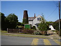
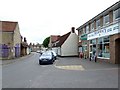
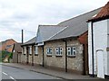
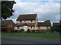
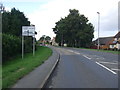
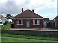
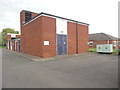
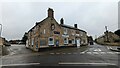
Photos of Metheringham


Area Information
Metheringham is a small built-up area covering just 1.1 km² in Lincolnshire. Living in this compact village offers close proximity to Lincoln, with a median age of 70 suggesting a community dominated by retirees. The area sits at a specific crossroads where rural tranquility meets necessary infrastructure. You will find a consistent environment shaped by its modest size and clear demographic profile. Homes in Metheringham cater primarily to an older demographic seeking stability. The village is characterised by a high rate of long-term residence rather than transient population shifts. Daily life moves at a steady pace, away from the frenetic energy of larger urban centres. Despite its small footprint, practical facilities are within easy reach. You can access local shops, a railway station, and airfield facilities without travelling far from your driveway. The small geographic spread ensures you will know your neighbours and the key landmarks around you. Metheringham provides a defined space for those who value a settled lifestyle over urban convenience. While the median age indicates an established community, the available transport links ensure you remain connected to wider opportunities. This balance of isolation and access defines the practical experience of residing here.
- Area Type
- Built Up Area 250
- Area Size
- 1.1 km²
- Population
- Not available
- Population Density
- Not available
Daily life in Metheringham centres on a select group of amenities within practical reach of residents. The Lincolnshire Co-operative Co and Spar provide essential retail needs for groceries and daily goods. Having two branches of the Co-operative Co adds convenience and reliability to your shopping routine. You can handle all standard errands without travelling beyond the immediate neighbourhood. Beyond retail, Metheringham offers Metheringham Railway Station for travel and RAF Waddington for aviation-related access. These facilities give structure to the community without creating a dense commercial high street. You will find a utilitarian approach to local facilities rather than a bustling leisure district. The presence of these amenities supports independent living for the 70-year-old median resident. Living in Metheringham means relying on well-maintained local services rather than a wide variety of entertainment options. The nearby schools, specifically The Metheringham Primary School, also serve as community gathering points. You will have access to necessary shops and transport links without overflowing commercial zones. This balance provides peace and convenience without the overwhelm of a city centre. All required services are reachable within a short drive or local walk.
Amenities
Schools
Families considering Metheringham will find The Metheringham Primary School as the nearest educational institution. This primary school holds a good Ofsted rating, indicating it meets standards for education and care. No secondary schools are listed within the immediate vicinity of this built-up area. Residents must transport their children to nearby towns for secondary education and beyond. The proximity of a good-rated primary school suggests that younger families are served locally if they reside in the village. However, the absence of a secondary option reinforces the area's profile as a home for older demographics. Students attending The Metheringham Primary School will benefit from a facility recognised for its quality. Parents should plan school runs to Lincolnshire for older children, as no secondary schools are located within the community. Schools near Metheringham are limited to this single primary option. The reliable Ofsted rating provides assurance regarding the quality of early education. You will find limited variety in local schooling, which aligns with the area's small population size. The school serves as a key community anchor despite the wide training routes required for older students. For those reviewing available education, the primary school is the only direct option located within Metheringham.
| Rank | School | Type | Entry gender | Ages |
|---|
Explore more schools in this area
Go to Schools tabDemographics
The community in Metheringham reflects a settled population with a median age of 70. This figure points directly to an area where long-term residents dominate the scene. Households are likely to consist of older couples or single occupants enjoying retirement years. Evidence suggests that 74% of people living in Metheringham own their homes outright or with a mortgage. This high ownership rate indicates financial stability and a desire to remain permanently established. The population composition skews significantly towards the over-60 age bracket compared to national averages. Such a profile often results in less transient behaviour and stronger neighbourhood ties. You will encounter a community where houses have remained within families for generations. Accommodation types here suit an older lifestyle, prioritising ease of access and established utility. The lack of data on specific ethnic groups or religious breakdowns confirms that homogeneity is a key feature of this village. Demographic data shows no significant influx of young families or students, which aligns with the median age. Living in Metheringham means joining a pocket community where life often slows down. The stability of the demographic makes it an attractive option for those seeking a quiet, predictable environment rather than the energy of a growing town.
Household Size
Accommodation Type
Tenure
Ethnic Group
Religion
Household Composition
Age
Household Deprivation
NS-SEC
Explore more demographic insights in this area
Go to Demographics tabPlanning
Planning Constraints
- Crime RiskPremium