Area Overview for Melton Warwick Ward
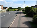
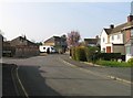
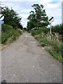
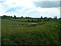
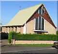
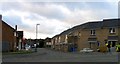
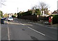
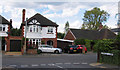
Photos of Melton Warwick Ward


Area Information
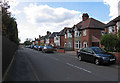
Melton Warwick Ward is a compact electoral ward situated within the town of Melton Mowbray in Leicestershire. This district occupies an area of 2.6 km² and sits centrally in Melton Mowbray near coordinates 52.748654, -0.882723. The location benefits from proximity to key transport arteries, specifically the A606 connecting to Nottingham and Oakham, and the A607 leading towards Leicester and Grantham. These roads intersect within the town, providing residents with direct access to major regional destinations. A North & East Melton Mowbray Distributor Road bypass is currently connecting these A-roads, withcompletion expected by early 2026. The ward represents one of six town wards administered by Melton Borough Council. Historical population figures from 2001 recorded 3,392 residents for this specific area. Living in Melton Warwick Ward offers a defined community setting within a larger market town environment. The central location ensures that daily travel requires less distance compared to outer suburban wards. The established road network supports both local movement and regional commuting. Residents here experience a blend of town life with relatively contained travel distances due to the ward's small footprint. The area forms a functional part of Melton Mowbray's wider urban structure.
- Area Type
- District Borough Unitary Ward
- Area Size
- 2.6 km²
- Population
- Not available
- Population Density
- Not available
Demographics
The community profile for Melton Warwick Ward reveals a mature population. The median age stands at 70 years, indicating that the average resident is considerably older than the national benchmark. Demographic data identifies Age: Total as the most common age range category within the recorded statistics. Home ownership is a defining feature of the local society, with 72% of residents owning their property outright or with a mortgage. This high ownership rate suggests a stable resident base over time. The ward does not provide specific breakdowns for household composition, predominant ethnic groups, or religious affiliations in the available records. Consequently, the demographic narrative focuses on age and tenure rather than diversity metrics. The lack of detailed ethnic or religious data means specific cultural compositions remain unquantified in this dataset. A significant portion of the population skews older, which often influences local service demand and community activities. The demographic picture is defined by stability through high ownership and a senior age profile. This contrasts with younger, more transient urban areas where rental tenancies and younger age groups dominate. Understanding the age distribution helps prospective buyers anticipate the general character of neighbourhoods they might enter.
Household Size
Accommodation Type
Tenure
Ethnic Group
Religion
Household Composition
Age
Household Deprivation
NS-SEC
Explore more demographic insights in this area
Go to Demographics tabPlanning
Planning Constraints
- Flood RiskPremium
- Ramsar Wetland SitesPremium
- Area of Outstanding Natural BeautyPremium
- Protected Nature ReservePremium
- Protected WoodlandPremium
- Crime RiskPremium