Area Overview for Melton Egerton Ward
Photos of Melton Egerton Ward
Area Information
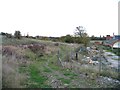
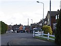
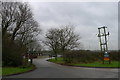
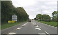
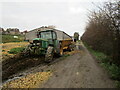
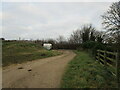
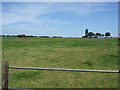
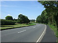
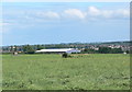
Melton Egerton Ward represents a compact residential district within the(entity) of Cheshire East, covering a total area of 3.6 square kilometres. Living in this ward offers a defined community experience characterised by its sizeable land mass relative to the density of surrounding urban sprawl. This area reflects a settled lifestyle where residents navigate a defined boundary with clear geographical limits. The character of the ward is shaped by its historical status as a district borough unit, which has influenced the local planning and infrastructure development over recent decades. You will find a neighbourhood that prioritises stability and localised convenience within a relatively small footprint. The compact nature of the ward means that daily amenities and local transit options are concentrated, reducing the need for extensive travel for routine errands. This layout supports a self-contained living experience where the immediate vicinity holds significant practical value. Prospective buyers should note that the ward operates with the efficiency of a smaller administrative unit, ensuring that local governance and community engagement remain focused on a specific population group. The physical constraints of the 3.6 km² area create a distinct identity that separates it from larger, more sprawling municipalities in the region. Understanding these geographical boundaries helps you grasp the scale of everyday life in Melton Egerton Ward.
- Area Type
- District Borough Unitary Ward
- Area Size
- 3.6 km²
- Population
- Not available
- Population Density
- Not available
Demographics
The community profile of Melton Egerton Ward reveals a population dominated by older residents. The median age sits precisely at 70 years, indicating that the majority of households consist of retirees or mature adults. You are looking at a community where the typical age range falls significantly higher than the national average, reflecting a shift away from young families and working-age professionals into this specific locale. Home ownership stands as a defining feature of daily life here, with 61% of residents owning their properties outright or through a mortgage. This high level of equity suggests a long-term settler population rather than a transient rental market. The ward does not feature a mixed bag of young professionals or student demographics; instead, the social fabric is woven by those seeking quiet retirement years. There is no breakdown provided for household composition types such as single-person homes versus multi-generational setups, which limits the ability to detail family structures. Similarly, specific data regarding ethnicity, religion, and accommodation types beyond the ownership split remains unavailable. This singular demographic focus creates an environment where local social events and community groups cater specifically to the interests and needs of the elderly. When considering schools near Melton Egerton Ward, potential buyers must recognise that the resident base may not align with typical family demographic requirements.
Household Size
Accommodation Type
Tenure
Ethnic Group
Religion
Household Composition
Age
Household Deprivation
NS-SEC
Explore more demographic insights in this area
Go to Demographics tabPlanning
Planning Constraints
- Flood RiskPremium
- Ramsar Wetland SitesPremium
- Area of Outstanding Natural BeautyPremium
- Protected Nature ReservePremium
- Protected WoodlandPremium
- Crime RiskPremium