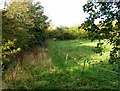
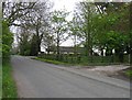
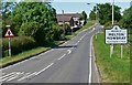
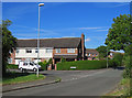
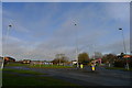
Area Overview for Melton Dorian Ward
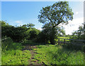
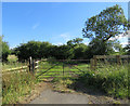
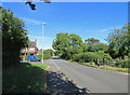
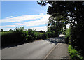
Photos of Melton Dorian Ward


Area Information
Melton Dorian Ward forms one of six administrative districts within the Borough of Melton in north-eastern Leicestershire. This specific ward covers an area of exactly 5.0 km², positioning it centrally within the broader urban landscape. The ward represents a significant portion of the local electorate, with 4,409 registered voters as of 2024. These residents elect a Conservative councillor to represent their interests at the borough level. Geographically, the ward falls inside the larger Melton and Syston parliamentary constituency, which accommodates a much wider population of 74,316 people. The area has maintained its current boundary structure since the last revision in 2003. Residents enjoy the stability of a unitary ward that has existed since the establishment of the borough in 1974. The ward offers a defined local identity within the historic market town of Melton Mowbray. Living in Melton Dorian Ward means being part of a structured local governance area with clear administrative lines. The proximity to the town centre suggests access to key local services and amenities. Daily life here revolves around the established communities that make up the ward's electorate.
- Area Type
- District Borough Unitary Ward
- Area Size
- 5.0 km²
- Population
- Not available
- Population Density
- Not available
Demographics
The community within Melton Dorian Ward displays a distinct age profile characterised by senior residents. The median age stands at exactly 70 years, indicating a population heavily weighted towards older age groups. While specific age-range breakdowns vary across total population metrics, this central figure highlights a demographic skews significantly older than the national average. Home ownership remains the dominant housing tenure in this area, with 68% of residents owning their property outright or with a mortgage. This high ownership figure suggests strong investment in the local real estate market and long-term residency. Household composition data reflects the total population without specifying single-parent or multi-generational arrangements in the provided figures. The ward records no specific data regarding predominant ethnic groups, suggesting a need to look at broader borough statistics for general diversity trends. Religious affiliation figures are similarly unlisted in the current dataset. Despite these gaps, the high home ownership rate implies stability. Living in Melton Dorian Ward often means dealing with a quieter, older demographic. The population size of 4,409 voters supports local community services. You can expect a neighbourhood where many residents have lived for decades.
Household Size
Accommodation Type
Tenure
Ethnic Group
Religion
Household Composition
Age
Household Deprivation
NS-SEC
Explore more demographic insights in this area
Go to Demographics tabPlanning
Planning Constraints
- Flood RiskPremium
- Ramsar Wetland SitesPremium
- Area of Outstanding Natural BeautyPremium
- Protected Nature ReservePremium
- Protected WoodlandPremium
- Crime RiskPremium