Area Overview for Melbourne Ward
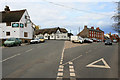
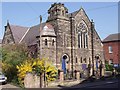
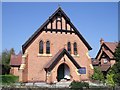
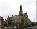
Photos of Melbourne Ward
Area Information
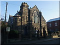
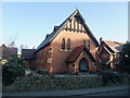
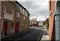
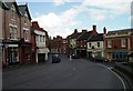
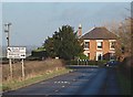
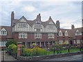
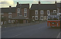
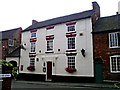
Living in Melbourne Ward offers a lifestyle rooted in centuries of history within South Derbyshire. This market town and civil parish occupies 20.6 square kilometres along the River Trent. The ward maintains a compact footprint yet supports a population of 2001 residents. You will find yourself in a location that originated as a royal manor recorded in the Domesday Book of 1086. The area retains its pastoral character while providing access to historic landmarks such as Melbourne Hall and the Norman parish church. Daily life here revolved around a quiet rhythm defined by the River Trent and historic streets like Potter Street. A population density of 1928 people per square kilometre suggests a semi-rural environment rather than a crowded urban centre. The proximity to the river and the presence of stone quarries worked in the 19th century shape the local landscape. Residents enjoy access to a market place and Grade II* listed Georgian structures. The town served as the birthplace of Thomas Cook, a fact that adds to its cultural significance. Homes in Melbourne Ward offer a connection to the past without the noise of major cities. The layout defined by a medieval royal manor site and expansive gardens provides a sense of space. You can commute from this location while remaining close to Derbyshire's natural features. The ward functions as a distinct community unit within the South Derbyshire district.
- Area Type
- District Borough Unitary Ward
- Area Size
- 20.6 km²
- Population
- 2001
- Population Density
- 1928 people/km²
Demographics
The demographic profile of Melbourne Ward reflects an established and stable community. The median age stands at 70 years old, indicating a population skewed significantly towards older residents. This age distribution suggests a neighbourhood where many families have remained for decades or retired to establish a permanent home. House ownership levels are high, with 72% of households owning their property outright or with a mortgage. This figure confirms that the area is predominantly occupied by individuals with long-term local ties rather than tenants. Household composition data indicates a static pattern typical of mature wards. You will find fewer young families moving in frequently compared to districts with younger age profiles. The high ownership rate of 72% implies low rental turnover and a settled community atmosphere. Accommodation types likely consist of traditional stone cottages and larger family homes associated with the historic manor. While specific ethnic diversity percentages are not listed, the historical context of the Hall and the town's age points towards a traditional demographic base. Religion and predominant ethnic groups are noted in the data summary, though specific breakdowns are not detailed in the available metrics. For someone considering buying here, the high stock of owner-occupied homes means less disruption from transient tenancies. Most properties in Melbourne Ward have been in the same hands for generations. The population size of 2001 remains stable, avoiding the volatility of rapidly changing areas. This stability creates a predictable environment for residents seeking a quiet retirement or a permanent foothold in Derbyshire.
Household Size
Accommodation Type
Tenure
Ethnic Group
Religion
Household Composition
Age
Household Deprivation
NS-SEC
Explore more demographic insights in this area
Go to Demographics tabPlanning
Planning Constraints
- Flood RiskPremium
- Ramsar Wetland SitesPremium
- Area of Outstanding Natural BeautyPremium
- Protected Nature ReservePremium
- Protected WoodlandPremium
- Crime RiskPremium