Area Overview for Measham North Ward
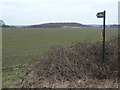
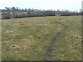
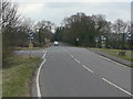
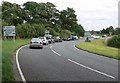
Photos of Measham North Ward
Area Information
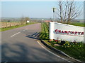
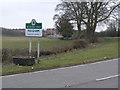
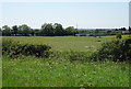
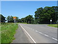
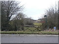
Measham North Ward offers a distinct residential experience within North West Leicestershire. This electoral ward covers an area of 5.2 km² and serves as a core part of the village of Measham. Residents live in a community centred around coordinates 52.70638132208199, -1.4955777544543984, which places the location in the East Midlands region of England. Historically, Measham was founded in the Saxon period between 350 and 1000 AD. The name translates to homestead on the River Mease, reflecting the area's long-standing connection to the landscape. This ward represents a mix of residential, industrial, and historical elements that have evolved over centuries. The site was once part of Derbyshire before transferring to Leicestershire. You will find that daily life here is anchored in a long history, with the manor passing through notable families such as the Earls of Chester and the De Measham family until 1308. St Laurence's Church, dating back to 1340, stands as a defining landmark alongside the historical footprint of Measham Hall, which was demolished in 1959 due to mining subsidence. Living in Measham North Ward means engaging with a place where you can see the layers of its past, from the royal estates recorded in the Domesday Book of 1086 to the Victorian markets granted in 1311. The area retains its character as a historic village while adapting to modern residential needs, offering you a sense of place defined by its river history and deep roots rather than transient development.
- Area Type
- District Borough Unitary Ward
- Area Size
- 5.2 km²
- Population
- Not available
- Population Density
- Not available
Demographics
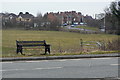
The community within Measham North Ward presents a clearly defined age profile characterised by older residents. Data confirms the median age for the population is 70. This high figure indicates a demographic shift towards retirement or later life stages. The most common age range is listed simply as Age: Total, suggesting the data aggregates the full population without specifying sub-ranges like 65 to 74. You should expect a situation where the built environment likely caters to older needs, given the clustering around this specific median. Home ownership is the dominant housing tenure, with 76% of households owning their property outright or with a mortgage. This high ratio suggests a stable community where long-term residents have settled for decades. Most households fall into the total category regarding composition, while accommodation types are similarly aggregated under an overall total. The ward does not display specific data on predominant ethnic groups or religious affiliations in the current figures. Despite the absence of these specific metrics, the high ownership rate often correlates with established, long-standing communities. When you consider living in Measham North Ward, you are entering an area where the majority of people live in homes they own. The age structure creates a quiet atmosphere, distinct from areas dominated by young families or students. You should understand that the 76% ownership rate means fewer buy-to-let investors and a stronger sense of local connection among residents.
Household Size
Accommodation Type
Tenure
Ethnic Group
Religion
Household Composition
Age
Household Deprivation
NS-SEC
Explore more demographic insights in this area
Go to Demographics tabPlanning
Planning Constraints
- Flood RiskPremium
- Ramsar Wetland SitesPremium
- Area of Outstanding Natural BeautyPremium
- Protected Nature ReservePremium
- Protected WoodlandPremium
- Crime RiskPremium