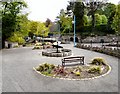
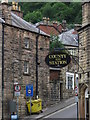
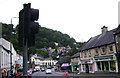
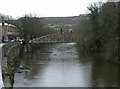
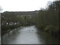
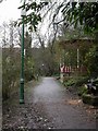
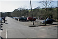
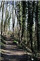
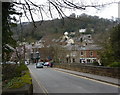
Area Overview for Matlock Bath
Photos of Matlock Bath


Area Information
Living in Matlock Bath offers a settled experience within a built-up area covering 46 hectares. You find yourself in a town characterised by historic charm and proximity to the Peak District. The community reflects a specific demographic trend with a median age of 70, suggesting a neighbourhood where older residents form the core of daily life. This population profile shapes the local rhythm, moving away from the bustle typical of younger urban centres. You will notice a distinct atmosphere built around lower noise levels and established routines rather than rapid change. The area functions as a residential hub where quiet streets meet accessible amenities without the congestion of a major city. Daily life revolves around local services and natural surroundings, offering a balanced pace for those seeking stability. Homes here provide a sense of permanence, supported by a landscape designed for long-term habitation rather than transient development. The 46-hectare footprint ensures you have significant green space immediately to hand while remaining close to essential town facilities. This combination of space and accessibility defines the practical reality of calling Matlock Bath your home.
- Area Type
- Built Up Area 250
- Area Size
- 46.0 hectares
- Population
- Not available
- Population Density
- Not available
Your daily life in Matlock Bath includes convenient access to major retail and transport hubs within reach. You can visit Morrisons Daily, Sainsburys Matlock, or Iceland Matlock for all weekly grocery requirements without leaving the immediate region. The town positions itself near Cromford Railway Station, Matlock Bath Railway Station, and Matlock Railway Station, giving you multiple options for rail travel across Derbyshire. If you need to explore further afield, services run towards Wirksworth, Darley Dale, and Rowsley South, connecting you to wider peaksdale experiences. These transport links ensure you are not isolated despite the peaceful setting. Retail needs are met by the five main stores nearby, so you do not face long queues in distant cities for essentials. The presence of these specific supermarket chains confirms a standard high-street offering available at your doorstep. Whether you are picking up fresh produce or household goods, the proximity of these five retail venues supports a self-contained weekly routine. Traveling by train adds flexibility to your weekend plans, allowing easy excursions to nearby villages or return to the town in an afternoon.
Amenities
Schools
Families considering homes in Matlock Bath will find one primary option listed within practical reach. Matlock Bath Holy Trinity CofE Controlled Primary School operates as a faith-based primary institution offering education to young children. This school holds a Good rating from Ofsted, confirming it meets the required standards for educational quality. The presence of this single primary school suggests a localised approach to early education rather than a cluster of competing institutions. For families settling in the area, this school provides a stable entry point into the local system without the need for complex catchment analysis across multiple zones. You must remain aware that this is the only primary establishment currently noted, meaning older children will likely need to commute to further secondary locations outside the immediate data set. The school's specific designation as a Church of England institution implies a religious ethos integrated into its curriculum, which may influence parental choice for those seeking faith-based education. While the selection appears limited for early years, the Good rating assures a baseline of performance for children attending in the Matlock Bath vicinity.
| Rank | School | Type | Entry gender | Ages |
|---|
Explore more schools in this area
Go to Schools tabDemographics
The community in Matlock Bath presents a clear picture of an area settled by older generations. With 76% of households in owner-occupied homes, the sense of local stability is high. You are entering a neighbourhood where long-term residents have invested in their properties and continue to live there. The median age of 70 indicates that the population skews significantly towards the elderly, creating a quiet environment typical of retirement destinations. Most households consist of single persons or couples without dependent children, influencing local demand for family-sized accommodation. While the data indicates this is a homogeneous group by age, the high ownership rate signals strong attachment to the locale. Deprivation is not highlighted in the current profile, focusing instead on a wealthy, settled community structure. The dominance of owner-occupied properties at three-quarters of all homes contrasts with areas where landlords and renters predominate. This high level of equity distribution means decisions regarding the local environment often reflect resident priorities rather than commercial interests. Living here means joining a community defined by stability and established tenure rather than fluid market dynamics.
Household Size
Accommodation Type
Tenure
Ethnic Group
Religion
Household Composition
Age
Household Deprivation
NS-SEC
Explore more demographic insights in this area
Go to Demographics tabPlanning
Planning Constraints
- Crime RiskPremium