Area Overview for Martinsthorpe
Photos of Martinsthorpe
Area Information
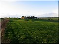
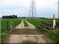
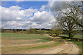
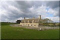
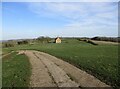
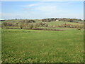
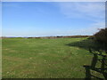
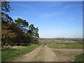
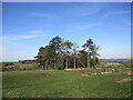
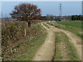
Living in Martinsthorpe offers a distinctly quiet experience within a civil parish covering 2.2 square kilometres. This small community sits away from the bustle of larger towns, giving residents a sense of space that is hard to find in denser counties. Daily life here revolves around a close-knit neighbourhood feel where familiarity with local streets is common. You will find that the area is defined by its compact nature, which means distances between amenities are short, though the immediate environment is primarily residential. The suburb feels established and settled, with a clear focus on local living rather than rapid growth or commercial expansion. For those considering homes in Martinsthorpe, the scale of the parish suggests a slower pace of life compared to neighbouring urban centres. The layout supports a lifestyle where you are not constantly commuting but are instead part of a defined, manageable living space. This particular parish provides a setting where individual properties have their own grounds or ample exterior space, contributing to the overall atmosphere of openness. Residents here value this stability, and the area maintains a consistent character that prioritises residential peace over high-density development.
- Area Type
- Parish
- Area Size
- 2.2 km²
- Population
- Not available
- Population Density
- Not available
Demographics
The community in Martinsthorpe reflects a settled population with a significant proportion of older residents. The median age across the parish is 70, indicating a neighbourhood where many adults are retired or approaching retirement. This age profile shapes the local culture, with activities and social interactions often centred around mature interests and leisure. Households primarily consist of individuals or couples rather than young families with multiple dependents. Home ownership is high, with 73 per cent of residents owning their homes outright or with a mortgage. This statistic reveals an area where people have chosen to stay long-term rather than renting transient property. The low rental market presence correlates with the older demographic structure and the slower rate of new household formation. You will not find a transient population or a transient workforce driving the day-to-day dynamics of Martinsthorpe. Instead, the social fabric is built on long-standing residents who have chosen to settle in this specific location. The dominance of owned accommodation suggests financial stability among the local population, as purchasing a home requires significant capital investment. This also means that property values may be sensitive to shifts in retirement housing demand. The composition of local households remains relatively steady, with few new generations moving in rapidly to alter the established social norms of the parish.
Household Size
Accommodation Type
Tenure
Ethnic Group
Religion
Household Composition
Age
Household Deprivation
NS-SEC
Explore more demographic insights in this area
Go to Demographics tabPlanning
Planning Constraints
- Flood RiskPremium
- Ramsar Wetland SitesPremium
- Area of Outstanding Natural BeautyPremium
- Protected Nature ReservePremium
- Protected WoodlandPremium
- Crime RiskPremium