Area Overview for Marsh Lane
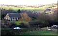
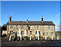
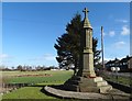
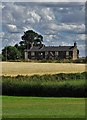
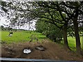
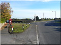
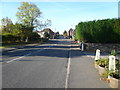
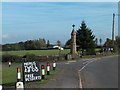
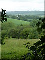
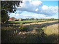
Photos of Marsh Lane


Area Information
Marsh Lane is a distinct built-up area within England, covering 32.5 hectares. This compact footprint suggests a residential zone designed for proximity rather than sprawling expansion. Living in this locality places you within a tight-knit community where daily routines often rely on local resources. The area functions as a practical residential hub, characterized by its defined boundaries and focus on housing. You will find yourself surrounded by neighbours rather than isolated in rural stretches or dense city centres. The layout supports a lifestyle where short journeys meet essential needs. This is a place for those who prioritise a settled environment over urban dynamism. Homes here sit within a specific urban context without the overwhelming scale of a major metropolis. The area represents a stable choice for buyers seeking a contained living space. Your daily life here will be structured around this specific parcel of land and the community it supports. It offers a straightforward, predictable setting for those moving to this part of the region.
- Area Type
- Built Up Area 250
- Area Size
- 32.5 hectares
- Population
- Not available
- Population Density
- Not available
Your lifestyle in Marsh Lane is supported by a practical network of nearby amenities within easy reach. Shopping convenience is handled by Co-op Eckington, Aldi Eckington, and Morrisons Mosborough, providing five retail options close by. You can manage weekly grocery shopping and essential purchases from these specific chains. Transport links are equally accessible, with five local metro stops including Birley Lane, Birley Moor Road, and Halfway Platform. These stations feed into the wider rail network, connecting you to Dronfield Railway Station, Woodhouse Railway Station, and Chesterfield Railway Station. A coach station is also available for regional travel needs. The layout offers five bus routes for local mobility, though only one major coach service is noted. Living here means you have five distinct retail outlets and five metro points at your fingertips. This concentration of services reduces the need to travel far for daily necessities.
Amenities
Schools
Families considering Marsh Lane have access to Marsh Lane Primary School, which is located nearby. This institution is a primary school with an Ofsted rating of good. The presence of a single named primary school within the vicinity speaks to the area's focus on early education. You will find no secondary schools or high schools listed in the immediate data for this specific area. A family moving here must consider how secondary education fits into their commute or relocation plans. The good rating of Marsh Lane Primary School suggests a reliable standard of education for younger children. This single data point confirms that the area supports early schooling needs effectively. If you require proximity to comprehensive or grammar schools, you will need to look beyond the boundaries defined by the schools near Marsh Lane. The educational infrastructure here is specialised for the early years of childhood development.
| Rank | A + A* % | School | Type | Entry gender | Ages |
|---|---|---|---|---|---|
| 1 | N/A | Marsh Lane Primary School | primary | N/A | N/A |
Explore more schools in this area
Go to Schools tabDemographics
The community in Marsh Lane is exceptionally mature, with a median age of 70 years. This figure indicates that the area is home to a predominantly elder population. You are likely to interact with residents who have lived here for decades. The demographic profile suggests retirement is a central theme of life in this district. Home ownership stands at 74%, meaning the vast majority of households own their properties outright. This high level of ownership reinforces the stability and long-term settlement of the residents. The data shows no evidence of younger families or recent migration driving the local culture. You will not find many students or young professionals making up the bulk of the neighbourhood. The population structure is uniform, with age being the primary defining characteristic. This lack of diversity in age groups means the social rhythm follows a senior-paced schedule. If you are looking for a young, mixed-age community, this location does not fit that description. The environment is tailored to those who have completed their careers and are settled into retirement.
Household Size
Accommodation Type
Tenure
Ethnic Group
Religion
Household Composition
Age
Household Deprivation
NS-SEC
Explore more demographic insights in this area
Go to Demographics tabPlanning
Planning Constraints
- Crime RiskLocked