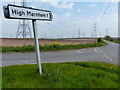
Area Overview for Marnham
Photos of Marnham


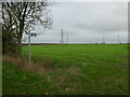
Area Information
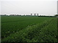
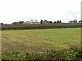
Living in Marnham means residing within a civil parish that covers exactly 10.0 km² in England. This area holds a distinct character defined by its demographic profile and geographical constraints. The community is notable for having a median age of 70 years, indicating a village where retirement and established household life dominate the daily rhythm. You will not find a youth-heavy culture here; instead, life moves at a pace suited to an older population. The sheer size of the parish is modest, meaning amenities and neighbours are likely within short walking or driving distance. This compact footprint shapes every aspect of local living, from where you can park your car to which shops are accessible without a lengthy journey. When you consider homes in Marnham, you are entering a space where the physical environment supports a quieter existence rather than a bustling urban lifestyle. The area's identity as a parish suggests traditional boundaries and local governance structures that have likely stood the test of time. Your experience here will be defined by proximity to other residents rather than isolation, provided you factor in the gentle gradient of age that characterises the whole settlement. Understanding this demographic reality helps you decide if a home in this specific tenure fits your life stage and future plans.
- Area Type
- Parish
- Area Size
- 10.0 km²
- Population
- Not available
- Population Density
- Not available
Demographics
The community structure in Marnham reveals a highly stable society where permanent residence is the norm rather than temporary accommodation. Data confirms that 75% of residents own their homes outright or via mortgage, which creates a neighbourhood deeply invested in long-term stability. This high ownership rate usually correlates with residents who have lived in the area for decades, guarding against rapid population turnover. Because most households own their properties, the shelter inventory remains relatively consistent, though the median age of 70 suggests that these homes may eventually require succession planning by family members. You will not encounter significant shifts in household composition due to the fixed nature of the owner-occupied stock. The population lacks diversity in terms of age, as the middle of the age distribution sits firmly at 70 years, meaning few people in their working peak years reside here compared to their elders. While specific figures on ethnicity and religious preference are not detailed in the available records, the homogeneity of the age profile suggests a community with shared life experiences. When you look at the total household data, the picture is one of established families or retired couples maintaining their status in the village. This static demographic profile means that the social fabric of Marnham relies heavily on mutual support and familiarity among its ageing residents.
Household Size
Accommodation Type
Tenure
Ethnic Group
Religion
Household Composition
Age
Household Deprivation
NS-SEC
Explore more demographic insights in this area
Go to Demographics tabPlanning
Planning Constraints
- Flood RiskPremium
- Ramsar Wetland SitesPremium
- Area of Outstanding Natural BeautyPremium
- Protected Nature ReservePremium
- Protected WoodlandPremium
- Crime RiskPremium