Area Overview for Markfield
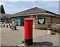
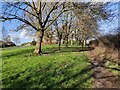
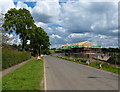
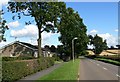
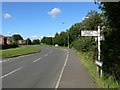
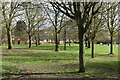
Photos of Markfield
Area Information
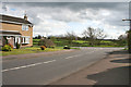
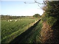
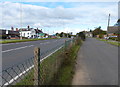
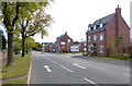
Markfield is a built-up area in England covering 1.6 square kilometres. It serves as a compact residential community where daily life revolves around local convenience rather than sprawling distances. The small footprint means that residents often know their local streets well, creating a tight-knit environment. You will find yourself surrounded by established neighbourhoods that have served the community for many decades. Living in Markfield offers a blend of suburban comfort without the anonymity of larger cities. The area functions as a practical base for those seeking a manageable lifestyle. Its size limits the scope for large developments, which preserves the character of the existing housing stock. You can walk to many essential services within a short distance. This compact nature makes it ideal for anyone who prefers quiet streets and local familiarity over urban sprawl. The area maintains a distinct identity within the wider region, offering a stable place to call home.
- Area Type
- Built Up Area 250
- Area Size
- 1.6 km²
- Population
- Not available
- Population Density
- Not available
Local amenities in Markfield are spread across several notable retail and transport locations. You can find five retail outlets within easy reach. Key providers include Co-op Main, Morrisons Daily, and Asda Browns. These stores offer essential groceries and daily necessities without the need for long commutes. For transport enthusiasts, there are four metro-related points of interest nearby. These include Rothley, Quorn and Woodhouse station, along with the Great Central Railway Heritage Centre. The heritage railway offers a unique leisure activity for residents seeking outdoor recreation and history. Living in Markfield means having access to a Co-op Main on your doorstep for quick shopping. The presence of Morrisons Daily and Asda Browns supports varied household needs. If you enjoy trains, the nearby Rothley station connects you to broader rail networks. The railway centre adds a cultural dimension to your weekly activities.
Amenities
Schools
Families in Markfield have access to Mercenfeld Primary School. This institution operates as a primary school for local children. The school holds a good Ofsted rating, confirming its quality of education. This rating provides assurance for parents considering the area for their children's upbringing. The presence of a local primary school suggests that the neighbourhood caters well to families with younger children. You will find that educational provisions are rooted directly within the community rather than relying solely on distant institutions. The good standing of Mercenfeld Primary School is a notable asset for those choosing to live in Markfield. There are no secondary schools listed in the immediate vicinity data, meaning older students likely travel to larger towns for further education. The area effectively supports the early years of schooling for residents. When evaluating Markfield for families, the quality official rating of the local primary school is the key educational metric available.
| Rank | School | Type | Entry gender | Ages |
|---|
Explore more schools in this area
Go to Schools tabDemographics
The community in Markfield shows a clear demographic profile. The median age is 70 years old, indicating a settled population. Most residents fall into the older adult category, shaping the social dynamics of the neighbourhood. Nearly 79 per cent of households own their homes outright. This high ownership rate reflects a long-term commitment to the area by existing residents. The majority of families have chosen to stay, leading to stability in the local community. You will encounter a population that values permanence over short-term living arrangements. The accommodation types reflect this history, favouring standard residential properties suited for retirement or established families. While specific ethnic breakdowns and religious affiliations are not detailed in available records, the area stands as a place where long-term residents have put down roots. This demographic reality influences local businesses and community groups. You are joining an area where the majority of people are homeowners who intend to remain for the foreseeable future.
Household Size
Accommodation Type
Tenure
Ethnic Group
Religion
Household Composition
Age
Household Deprivation
NS-SEC
Explore more demographic insights in this area
Go to Demographics tabPlanning
Planning Constraints
- Crime RiskPremium