Area Overview for Maidenwell
Photos of Maidenwell
Area Information
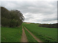
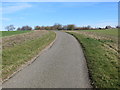
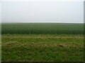
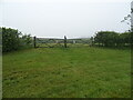
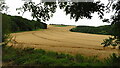
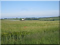
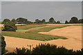
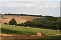
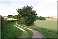
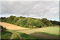
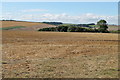
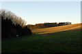
Living in Maidenwell defines a distinct chapter for those seeking life within a civil parish of England. You will reside in a parish covering an area of 18.6 km², a space that offers a specific containment and quietness away from larger urban centres. The character here is one of established rural living, where the pace of daily life moves deliberately. Prospective homeowners should understand that this location is not a bustling metropolitan hub but a focused community with defined boundaries. The size of the parish suggests a compact environment where distances between key points are manageable on foot or by local transport. You find yourself in a setting where the built environment is balanced against the natural surroundings typical of this region. This overview sets the stage for understanding a place where property values reflect stability and longevity rather than rapid development. When you consider the option of purchasing a home here, you are entering a market governed by the unique constraints and Attributes of a designated civil parish. The area does not boast soaring population figures or major commercial districts, yet it offers a recognised status within the administrative structure of the country.
- Area Type
- Parish
- Area Size
- 18.6 km²
- Population
- Not available
- Population Density
- Not available
Demographics
The community in Maidenwell presents a clear picture of an elderly, settled population. The median age stands at 70, meaning half of all residents are older than this figure and the other half are younger. You will find that the age demographic skews significantly towards seniors, a fact confirmed by the designation of the most common age range as 'Age: Total'. This data point, while brief, underscores the dominance of older adults within the local social fabric. Home ownership in Maidenwell is extensive, with 70% of households owning their properties outright or with a mortgage. This level of ownership creates a stable community where residents have a long-term stake in the area. The remaining 30% of households are likely renting or living in accommodations other than owned properties. Accommodation types and household composition figures are available as 'Total', indicating a standard distribution of housing forms suitable for this age group. The predominant ethnic group and religious affiliations are listed as 'Total', reflecting a standard national representation without distinct local clustering. This demographic profile shapes the local services, suggesting a need for healthcare and leisure facilities catering to older adults rather than young families. Living in Maidenwell, you join a neighbourhood where generation gaps are wide and community bonds are often based on long-term residence rather than recent migration.
Household Size
Accommodation Type
Tenure
Ethnic Group
Religion
Household Composition
Age
Household Deprivation
NS-SEC
Explore more demographic insights in this area
Go to Demographics tabPlanning
Planning Constraints
- Flood RiskPremium
- Ramsar Wetland SitesPremium
- Area of Outstanding Natural BeautyPremium
- Protected Nature ReservePremium
- Protected WoodlandPremium
- Crime RiskPremium