Area Overview for Lutton
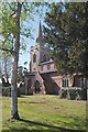
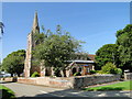
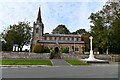
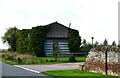
Photos of Lutton
Area Information
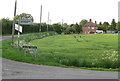
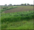
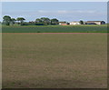
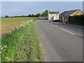
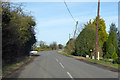
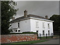
Living in Lutton offers a quiet alternative to nearby towns, situated within a built-up area covering 23.6 hectares. You will find a community that has long been established in Lincolnshire, where daily life moves at a measured pace. The area functions as a defined residential pocket within the wider countryside, yet it remains close enough to access essential services without crossing into a bustling city centre. Residents typically navigate the neighbourhood's roads to reach shops or head to the Lutton St Nicholas Primary Academy for educational outings. With over 70% of your neighbours likely owning their homes, the atmosphere encourages stability rather than constant turnover. This area suits those who value solitude and space while maintaining a link to the broader community network.
- Area Type
- Built Up Area 250
- Area Size
- 23.6 hectares
- Population
- Not available
- Population Density
- Not available
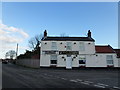
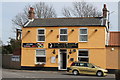
Daily life in Lutton is practical, centred on just five retail outlets within easy reach. You can visit the Lincolnshire Co-operative Co and the Spar store for your weekly shopping needs. These shops provide access to essential groceries and household items without requiring a long drive to a larger town. The limited number of commercial venues reflects the area's quiet character, where residents walk to local stores rather than relying on major high streets. While options for dining or entertainment are minimal, the focus remains on convenience and the essentials. Neighbours likely know their local shopkeepers by name, creating a personal connection within these small businesses. For those who enjoy a simple routine, having these amenities nearby ensures that getting food or daily necessities takes only minutes of your time.
Amenities
Schools
Families considering living in Lutton have two primary educational options located directly within the area. You will find Lutton St Nicholas Primary School and its iteration, Lutton St Nicholas Primary Academy. Both institutions serve as the main sources of primary education for children residing in the neighbourhood. The Academy holds a 'good' rating from Ofsted, confirming that it meets the required standards for quality and care. While secondary education options are not detailed for this specific built-up area, these primary facilities provide a solid foundation for younger children. The presence of these two schools suggests a tight-knit educational community where local parents often share the same resources. This concentration of providers ensures that daily commutes to schooling are short and manageable.
| Rank | School | Type | Entry gender | Ages |
|---|
Explore more schools in this area
Go to Schools tabDemographics
The community in Lutton reflects a mature demographic, with a median age of 70 years. This profile indicates that the population is significantly older than the national average, suggesting a retirement-focused settlement rather than a young family hub. You are joining a neighbourhood where long-term residents have deep roots, evidenced by the high rate of home ownership standing at 77%. This level of ownership implies that most households have remained in their properties for extended periods, fostering strong local knowledge and social cohesion. The area does not feature a significant influx of transient workers or young professionals seeking rental accommodation. Instead, the population consists of settled individuals who appreciate the stability of their surroundings. This steady demographic means the local energy is often leisurely, oriented towards rest and quiet recreation.
Household Size
Accommodation Type
Tenure
Ethnic Group
Religion
Household Composition
Age
Household Deprivation
NS-SEC
Explore more demographic insights in this area
Go to Demographics tabPlanning
Planning Constraints
- Crime RiskPremium