Area Overview for Low Fulney
Photos of Low Fulney

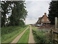


Area Information
Living in Low Fulney offers a settled experience within a built-up area of 76.2 hectares. This community is part of the wider town environment, providing a familiar streetscape for residents who value stability. The area serves as a distinct residential zone where daily life revolves around proximity to local services and established neighbourhood patterns. You will find that the layout supports a routine centered on practical access to essentials rather than sprawling suburban distances. Prospective homebuyers often seek this location for its established nature and integration into the broader local infrastructure. The size of the area means you are settled in a compact environment where distances to key spots remain manageable for a typical commute or weekend trip. When considering homes in Low Fulney, you enter a market defined by its long-term residents and standard urban amenities. The area does not cater to a transient population but rather supports families and individuals looking for a grounded place to settle. Your daily journey here involves navigating straightforward routes to nearby retail parks and transport links. The character of Low Fulney is defined by its function as a residential hub within a larger town setting, where the pace of life aligns with practical needs. You gain a sense of continuity here, moving through streets that have supported similar households for decades. This consistency forms the backbone of living in this specific built-up zone.
- Area Type
- Built Up Area 250
- Area Size
- 76.2 hectares
- Population
- Not available
- Population Density
- Not available
Your daily life in Low Fulney is supported by a cluster of amenities within practical reach. Five retail outlets offer convenient shopping options for groceries and household essentials. You will find Tesco Spalding, M&S Springfields, and Lidl Spalding nearby, providing choices for weekly grocery runs and general shopping. These supermarkets and stores are situated close enough to be visited frequently, allowing you to stock up on supplies without a lengthy commute. Having these chains accessible means you do not need to travel far for daily necessities, saving time and fuel. Transport links extend your lifestyle possibilities beyond local boundaries with Spalding Railway Station available for regional travel. This rail connection integrates you into the broader transport network, enabling trips to the city centre or other local towns. The presence of these specific venues—Tesco, M&S, Lidl, and the railway station—defines the convenient, service-oriented nature of living here. You gain the advantage of having major high street brands and rail connections just a short drive or bus ride away. This mix of retail and transport creates a lifestyle where practical needs are met without extensive planning. Residents enjoy the balance of local convenience with access to wider regional opportunities.
Amenities
Schools
| Rank | School | Type | Entry gender | Ages |
|---|
Explore more schools in this area
Go to Schools tabDemographics
The community in Low Fulney presents a distinct age profile with a median age of 70. This figure indicates a population skewed significantly towards older adults, likely comprising retired individuals or long-term residents. You are entering a neighbourhood where the demographic makeup is dominated by the septuagenarian cohort. This concentration suggests a quiet atmosphere where life moves at a deliberate pace and social interactions often revolve around shared experiences of retirement living. Understanding this age range helps you anticipate the neighbourhood noise levels and the kind of social activities prevalent in community centres or parks nearby. Home ownership stands at 60 per cent across the total household composition in this area. This statistic reveals a balanced mix, though it leans slightly towards owner-occupiers rather than a fully rented sector. You will find that most homes in Low Fulney have owners who have stayed put for extended periods, contributing to the strong age demographic. The household composition is total, reflecting a cohesive group of residents living in various accommodation types tailored to different stages of later life. While specific data on family structures or diversity breakdowns is not detailed in the available records, the high home ownership rate points to a stable, investment-driven market rather than a transient rental zone. Residences here cater to those who have built a permanent home base.
Household Size
Accommodation Type
Tenure
Ethnic Group
Religion
Household Composition
Age
Household Deprivation
NS-SEC
Explore more demographic insights in this area
Go to Demographics tabPlanning
Planning Constraints
- Crime RiskPremium