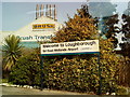
Area Overview for Loughborough East Ward
Photos of Loughborough East Ward


Area Information
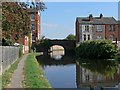
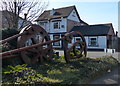
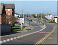
Living in Loughborough East Ward offers a residential experience defined by its compact footprint and established community character. This district constitutes a specific borough unitary ward covering an area of 6.2 square kilometres. It stands as a distinct locality within the wider borough of Loughborough, providing a focused living environment for its residents. The ward combines the benefits of proximity to town amenities with the quieter feel often found in such defined urban boundaries. You are navigating a space where daily life revolves around the practical realities of a dense urban area without the overreach of planned green belts. The sheer size of the ward suggests a walkable neighbourhood where local services and housing are concentrated in close proximity. Prospective buyers appreciate knowing the exact boundaries of their future home, which in this case is encapsulated within these 6.2 km². While the area lacks designated protected statuses like AONBs or Ramsar sites, it maintains a clear urban identity. The ward functions as a standard part of the local government structure, ensuring that services are delivered through the established borough framework. Your life here is grounded in the specifics of this defined geographical unit rather than abstract regional planning concepts. This clarity helps you understand where you live within the administrative map of England. The area serves as a functional residential zone where community life integrates seamlessly with the surrounding town.
- Area Type
- District Borough Unitary Ward
- Area Size
- 6.2 km²
- Population
- Not available
- Population Density
- Not available
Demographics
The community within Loughborough East Ward reflects a mature population profile, with a median age of 70 years. This demographic data indicates a significant proportion of older residents calling this 6.2 square kilometre area home. You are likely to encounter a neighbourhood where living arrangements suit those in later life stages. The predominance of this age group shapes the local pace and the types of social activities available within the ward. Ownership dynamics reveal that 42% of households in Loughborough East Ward hold their homes as owner-occupied residences. This figure is notably lower than the national average, suggesting a higher prevalence of rented accommodation or shared living situations among the population. Household composition data confirms the broad range of living arrangements present, from single occupants to families, though the age skew tips the balance. The mix of residents creates a specific community rhythm where elderly care services and pensioner groups may play a larger role than in younger wards. You should expect a society where intergenerational support is a practical necessity. The accommodation types accommodate these varied needs, although specific breakdowns by building style remain unlisted. Ethnic diversity and religious affiliation data are not separately itemised in the provided statistics, meaning the ward blends into the wider, generally diverse profile of Loughborough borough without standout isolated figures. Your daily interactions will be with a population that values stability within this established urban setting.
Household Size
Accommodation Type
Tenure
Ethnic Group
Religion
Household Composition
Age
Household Deprivation
NS-SEC
Explore more demographic insights in this area
Go to Demographics tabPlanning
Planning Constraints
- Flood RiskPremium
- Ramsar Wetland SitesPremium
- Area of Outstanding Natural BeautyPremium
- Protected Nature ReservePremium
- Protected WoodlandPremium
- Crime RiskPremium