Area Overview for Loughborough
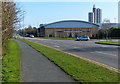
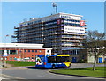
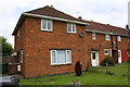
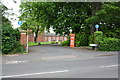
Photos of Loughborough

Area Information
Living in Loughborough means settling into a built-up town that forms a cohesive community within the wider English landscape. As a designated built-up area containing approximately 29,665 residents, the town concentrates its population into a relatively compact footprint of 15.3 square kilometres. This high density results in a population density of 1,933 people per square kilometre, creating a neighbourhood where daily interactions are frequent without the overwhelming sprawl of major metropolitan hubs. The area has matured into a self-contained entity that supports independent living for thousands of households. Residents navigate a landscape where local services cluster closely together, reducing the need for long daily commutes within the town itself. The character of Loughborough is defined by this concentrated urban structure, which facilitates easy pedestrian access to key locations. Whether you are walking from one part of the 15.3 km² zone to another, you move through an established environment designed for practical living. The town functions as a complete unit, blending residential zones with essential services to create a straightforward living experience. This density ensures that the distance between your home, your workplace, and your local amenities remains manageable for most residents. It is a place where life proceeds at a predictable pace, underpinned by a clear, defined urban boundary and a population that shares the same physical space.
- Area Type
- Built Up Area 250
- Area Size
- 15.3 km²
- Population
- 29665
- Population Density
- 1933 people/km²
Daily life in Loughborough is supported by a practical array of amenities located within easy reach of the 15.3 km² residential zone. Retail options are concentrated around specific hubs, with Co-op UNIF, Sainsburys Loughborough, and Iceland Loughborough serving as key providers for groceries and household essentials. You do not need to travel far to stock up on supplies or handle weekly shopping. For leisure, the nearby amenities include East Midlands Airport, which offers travel opportunities for residents who wish to fly within the same day. Public transport nodes such as Loughborough Railway Station and the bus stops at Quorn and Woodhouse ensure that you can reach these retail and travel sites quickly. The town also caters to those who need specific banking services, although detailed bank names are not listed beyond the general audit of local commerce. The availability of three metro-style stops or key transit points suggests a focus on public mobility. Life here involves a balance of accessing major retailers like Sainsburys and Iceland while maintaining proximity to transport links that lead to broader networks. The density of the population ensures that these services remain visible and accessible. Residents can walk to many daily necessities, reducing reliance on cars for short trips. This convenience is a core part of the living experience, allowing for a more relaxed approach to daily errands.
Amenities
Schools
Families looking at Loughborough have access to a range of primary education options scattered throughout the neighbourhood. Rendell Primary School operates within the area as a central facility for younger children. You will also find Thorpe Acre Junior School and Thorpe Acre Infant School, both of which hold a good Ofsted rating, offering parents a choice of high-quality local education for their children aged five to eleven. Booth Wood Primary School and Outwoods Edge Community Primary School round out the selection of primary institutions available to residents. These schools provide foundational education before pupils move on to secondary institutions nearby or further away. The existence of multiple primary schools within commuting distance indicates that the town has a sustained interest in early education infrastructure. Parents can choose from different environments to suit their family's needs, from the basic structure of traditional infant schools to community-focused approaches. Schools near Loughborough play a vital role in the local ecosystem, with staff serving communities across the 15.3 km² area. The good rating of Thorpe Acre Infant School and Thorpe Acre Junior School provides reassurance to families researching educational standards. While data on secondary schools is not provided in the current metrics, the density of primary options suggests a robust educational base for the 29,665 residents. Education remains a key factor for anyone considering moving to the area to raise children.
| Rank | School | Type | Entry gender | Ages |
|---|
Explore more schools in this area
Go to Schools tabDemographics
The demographic profile of Loughborough reveals a community with a distinct age skew. Data indicates a median age of 70 years, suggesting that a significant portion of the population consists of older residents who have chosen retirement living in the area. This age distribution heavily influences the local market and community focus, prioritising facilities and services suitable for later life stages. Home ownership stands at a impressive 58 per cent, a figure that significantly exceeds the national average and points to a neighbourhood where long-term stability and equity are common. You will find that the majority of households in Loughborough are owner-occupiers rather than tenants, creating a settled residential fabric. The high rate of ownership suggests that many families or individuals bought properties intending to stay for the long term. This pattern contrasts with areas where rental markets dominate, offering a degree of permanence in the community. While specific breakdowns of household composition and accommodation types are not detailed in the current statistics, the 58 per cent ownership rate is a definitive fact shaping the area's character. The population density of 1,933 people per square kilometre reflects a town that accommodates its residents within a concentrated space. Little Box is not mentioned in the data, so no specific claims can be made about it. The sheer number of homes combined with the age profile paints a picture of a quiet, established town rather than a dynamic youth hub.
Household Size
Accommodation Type
Tenure
Ethnic Group
Religion
Household Composition
Age
Household Deprivation
NS-SEC
Explore more demographic insights in this area
Go to Demographics tabPlanning
Planning Constraints
- Crime RiskPremium